Structural Control
of Landforms
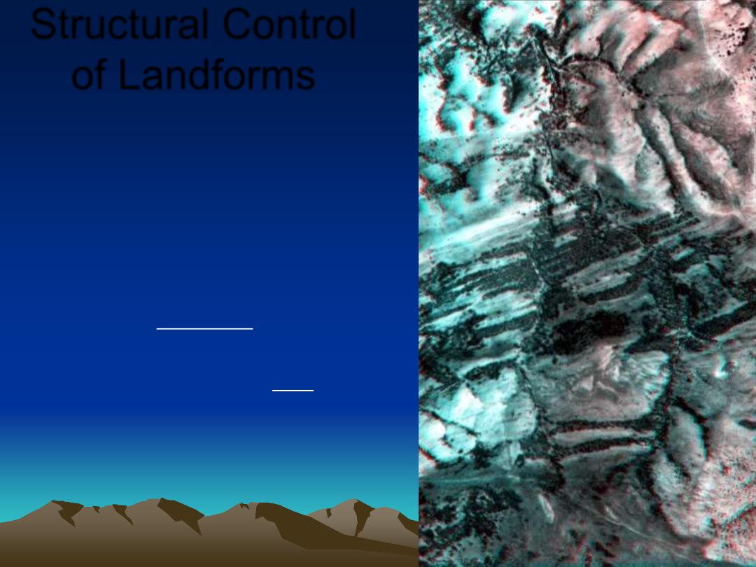
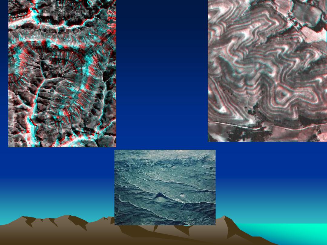
Photo from Drury: Two distinct units. One dendritic
drainage pattern is sparsely vegetated. Parallel
contours suggest it is horizontal. Other formation
banded, with straight wooded ridges, controlled by
steep dips. The boundary truncates the ridges.
Horizontal unit lies unconformably on the steeply
dipping strata (angular unconformity).
The wide spacing of drainage in the younger unit
suggests that it is a massive, coarse clastic
rock. The older unit comprises shales and
limestones. From Steve Drury, Image Interpretation
in Geology
,
adopted for this course
Plus a review of folds and faults
From our lab workbook Image
Interpretation in Geology by Steve Drury
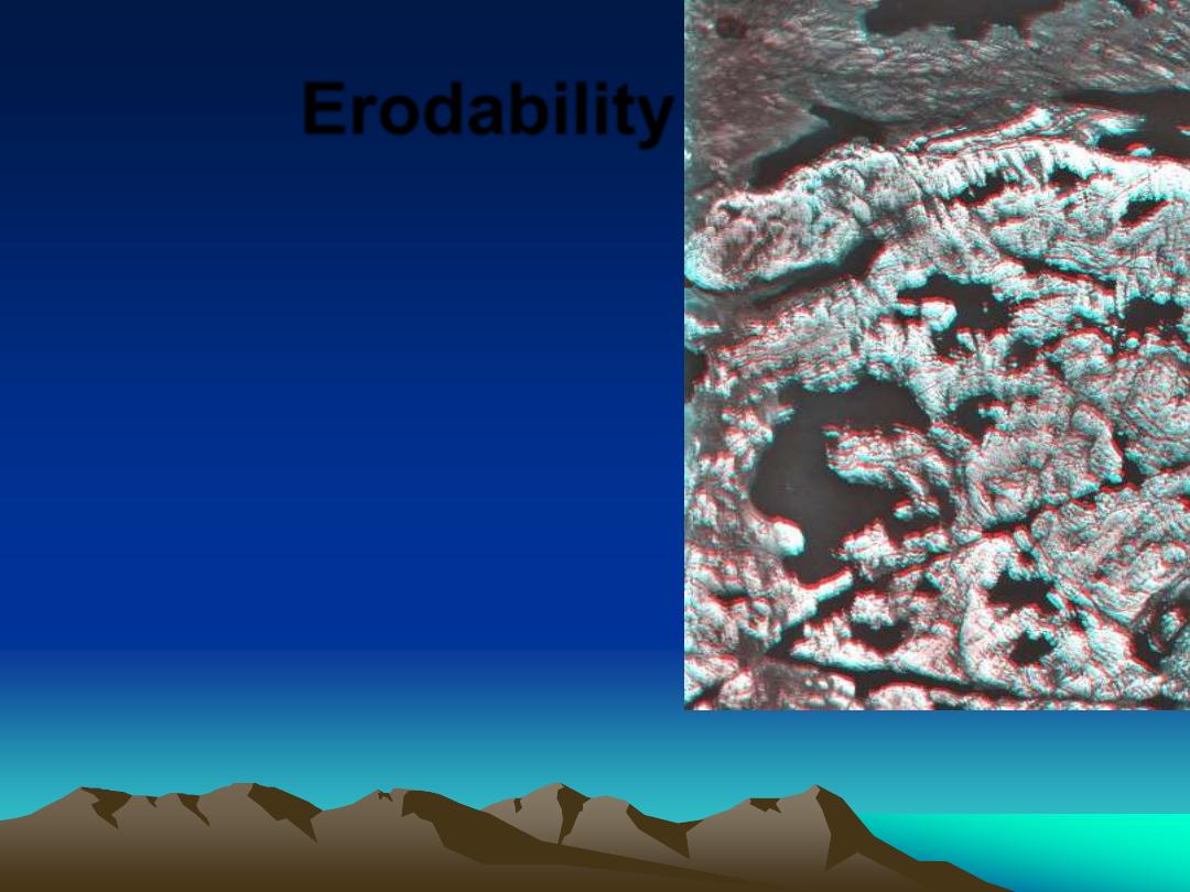
Erodability
•
Relative Erodability
– Layered rocks = wide range
•
Sedimentary
•
Volcanic
– Massive rocks = narrow range
•
Metamorphic
•
Intrusive igneous
– Erodability is not absolute but
•
typically shale > limestone > sandstone ~ gneiss
Canadian Shield.
Pale granite and
darker metavolcanic
rocks, the granite
having resisted
glaciation best.
Drury IIG
Erodability
•
"
… shale, limestone, marble and some
types of [mica] schist are less resistant
"valley-makers" in humid climates"
…
•
"whereas [quartz] sandstone, quartzite,
[quartz] conglomerate and various igneous
rocks [ granite has ~20% quartz H= 7] are
resistant "ridge-makers"
….
•
Easterbrook (1969) Principles of Geomorphology
[words in brackets added]
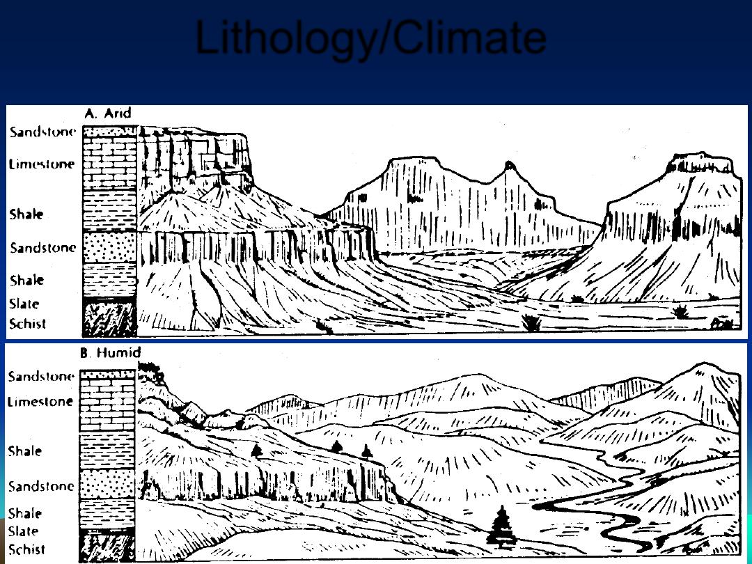
Lithology/Climate
Erodability: shale > limestone > sandstone ~ gneiss
In humid areas, weathering and erosion are faster, slopes are more eroded,
gentler after the same duration of exposure to weathering
In arid terrains (a) the
intermittent violent
erosion develops
steep-sided gullies
and valleys. Note
differential erosion
Horizontally
layered rocks
– outcrops
parallel
topographic
contours.
In humid climate the
topography is more muted.
Monadnocks resistant rock ridges Colorado
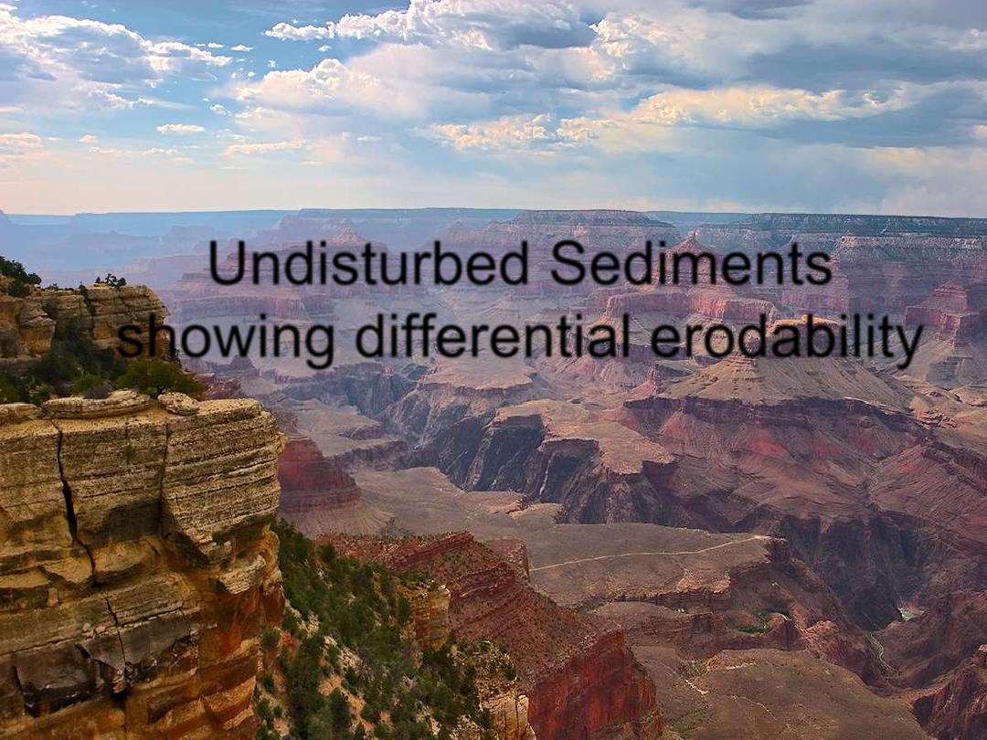
Undisturbed Sediments
showing differential erodability
Dry Climate, intermittent strong storms
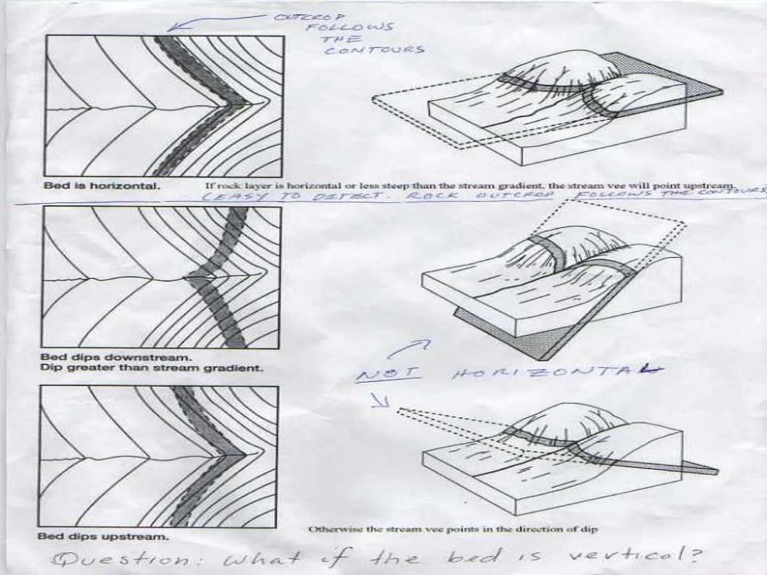
Review: Stream Vees
Vees are pointing in direction of dip
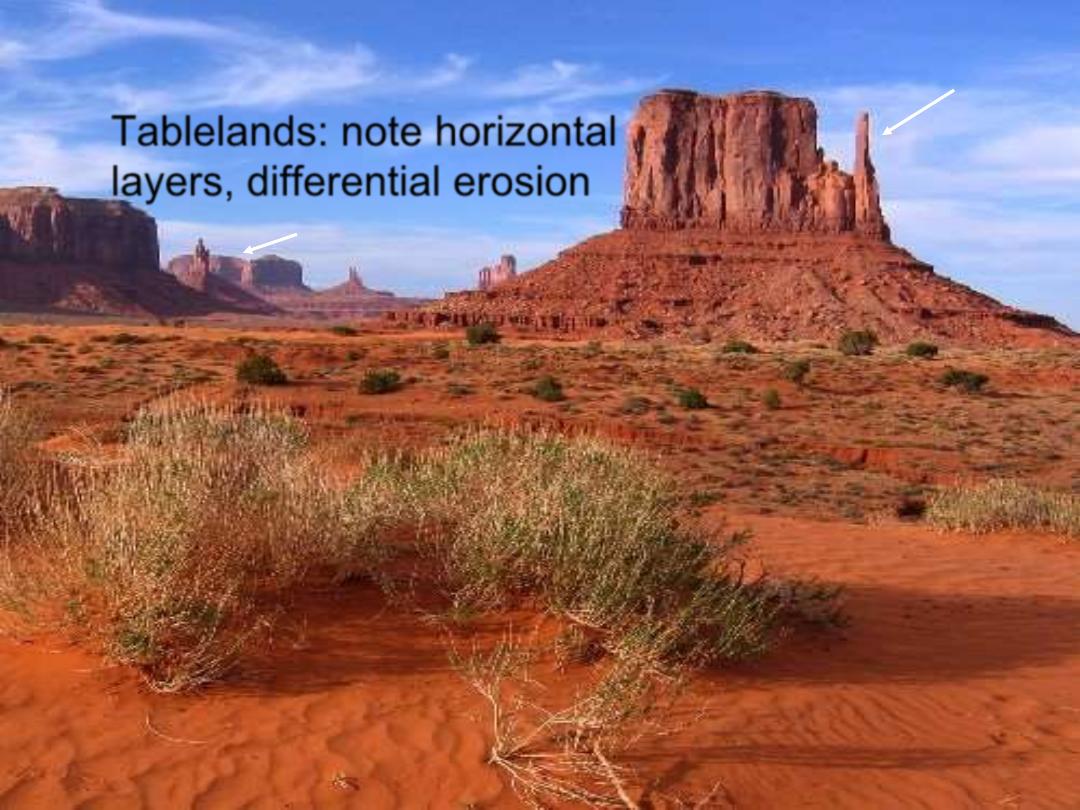
Tablelands: note horizontal
layers, differential erosion
•
Plateau>mesa>butte>chimney
•
Ratio surface area of top to height
Dry Climate, intermittent strong storms
In horizontal beds, rock outcrops
would follow contours
Pediment
(gentle slope < 5%,
erosional concave up surface
w thin veneer of gravel etc.)
Inselberg
mesa
Butte chimney
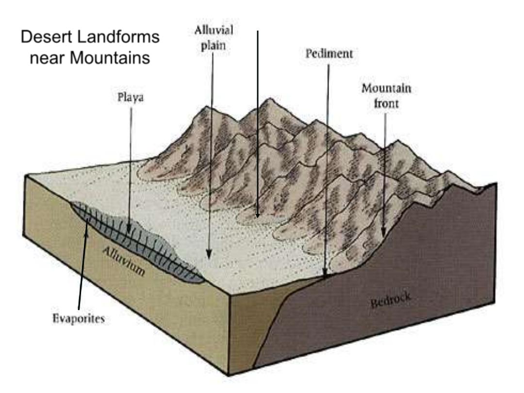
Desert Landforms
near Mountains
Alluvial Fan
(often exposed bare rock
with gravel veneer)
Mountains eventually erode away to Inselbergs
Rain-shadow desert in
the lee of mountains
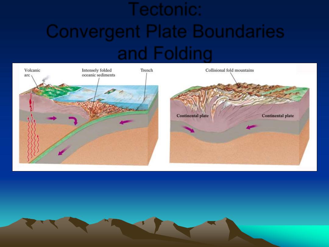
Tectonic:
Convergent Plate Boundaries
and Folding
Subduction causes Arc: Under
Ocean Lithosphere Japan,
Aleutians, Cent. Am.; under
continent Andes, Cascades
Continent-Continent
collision forms
Fold and Thrust Mountains:
Alps, Himalayans,
Appalachians
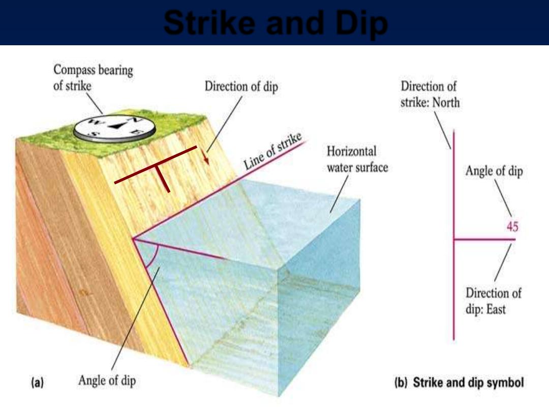
Strike and Dip
Strike intersection w horizontal, dip perpendicular, angle from horizontal down toward surface
Map Symbols: Strike shown as long line, dip
as short line. Note the angle of dip shown: 45
o
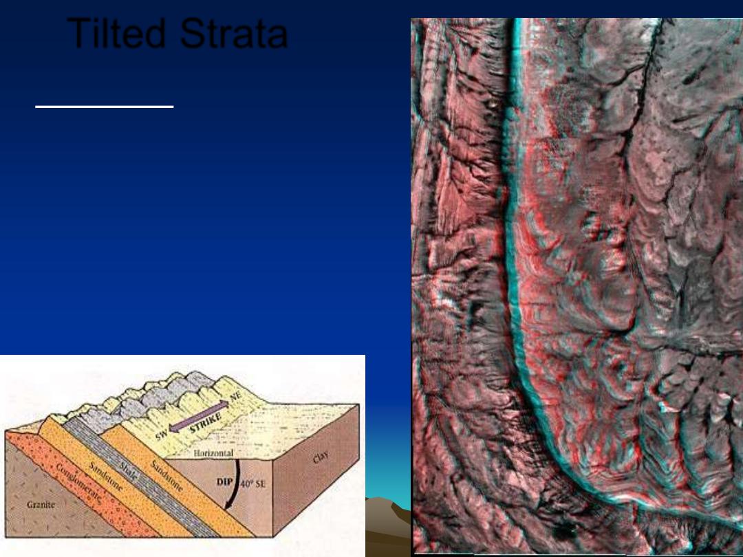
Tilted Strata
•
Monoclinal folds, or one
side (limb) of a fold
•
Name = f(dip angle)
– Cuesta (moderate dip)
– Hogback (steep dip)
– Flatiron remnant of
dissected Hogback w
triangular face
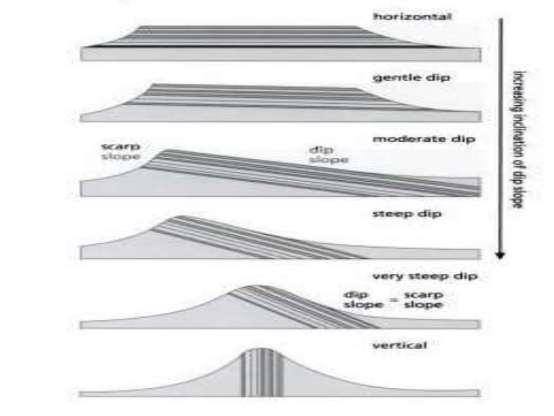
Dip Slope vs. Scarp slope
Hogback
Cuesta
Hogback dip slope greater 30°
- 40° with near symmetric
slope on each face
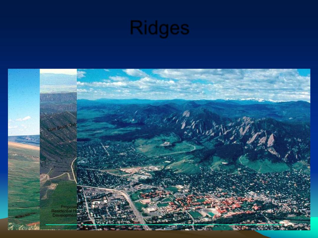
Ridges
•
Dip of Cuesta < Hogback
Copyright © J. Michael Daniels 2002

Folds are typical of convergence
Folded Rock Before Erosion
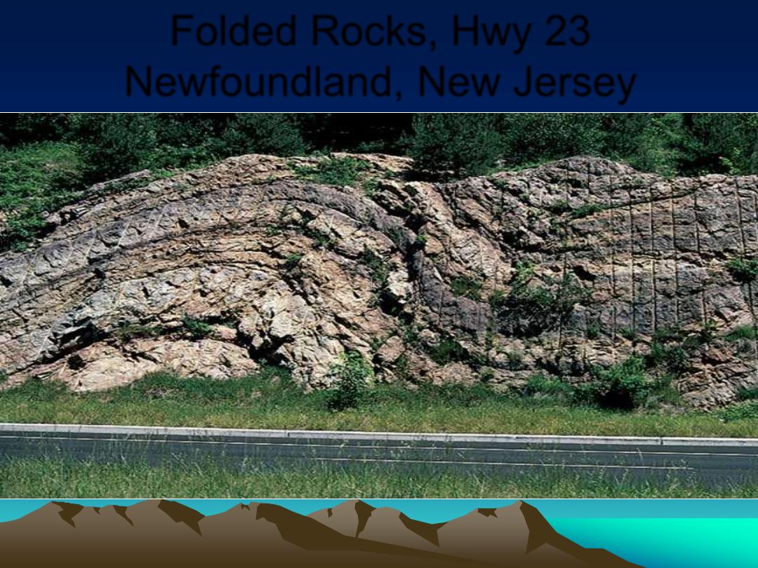
Folded Rocks, Hwy 23
Newfoundland, New Jersey
Source: Breck P. Kent
Adjacent Anticline and Syncline
Note highest point
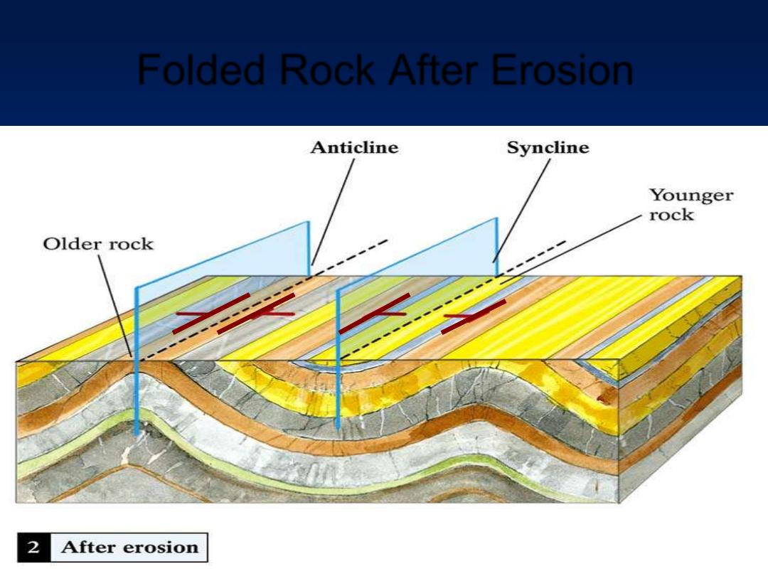
Folded Rock After Erosion
Eroded Anticline, older rocks in center. Syncline is opposite.
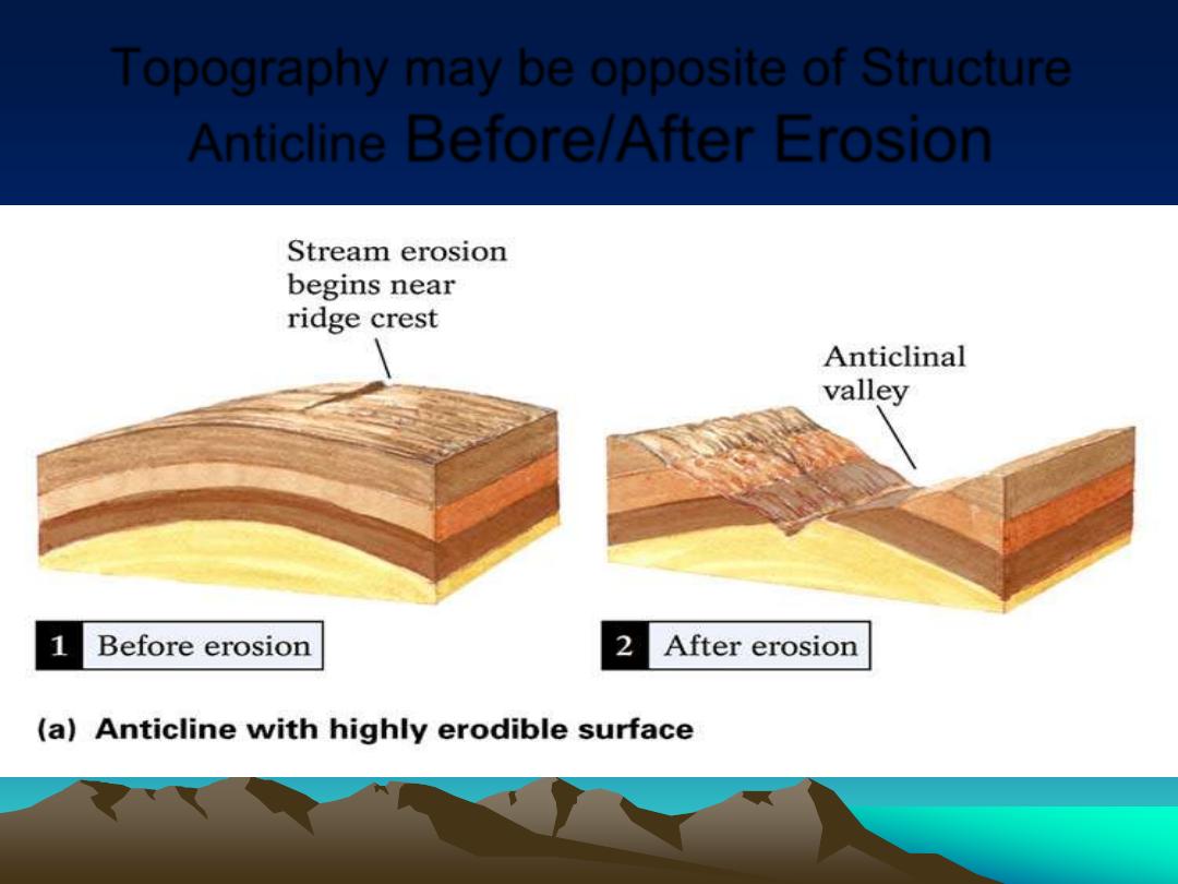
Topography may be opposite of Structure
Anticline
Before/After Erosion
Notice center rock oldest
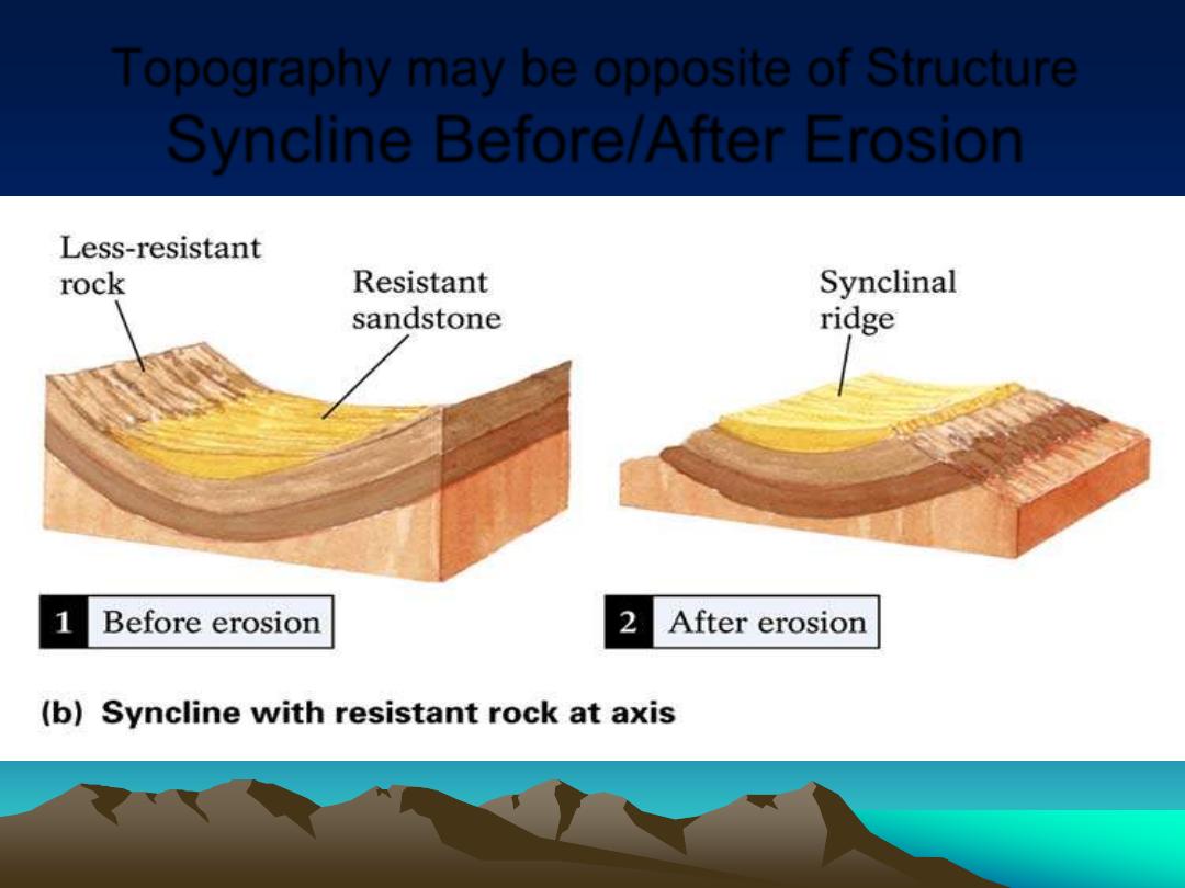
Topography may be opposite of Structure
Syncline Before/After Erosion
Notice center rock youngest
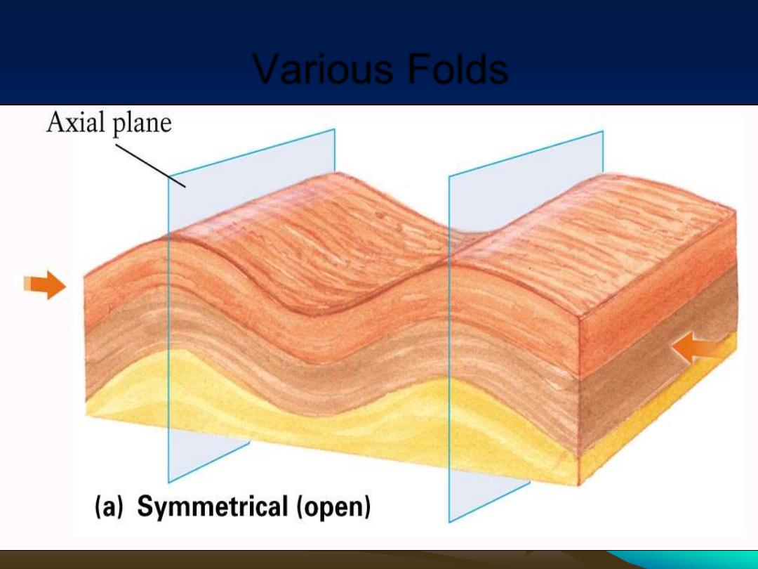
Various Folds
Various Folds (cont'd)
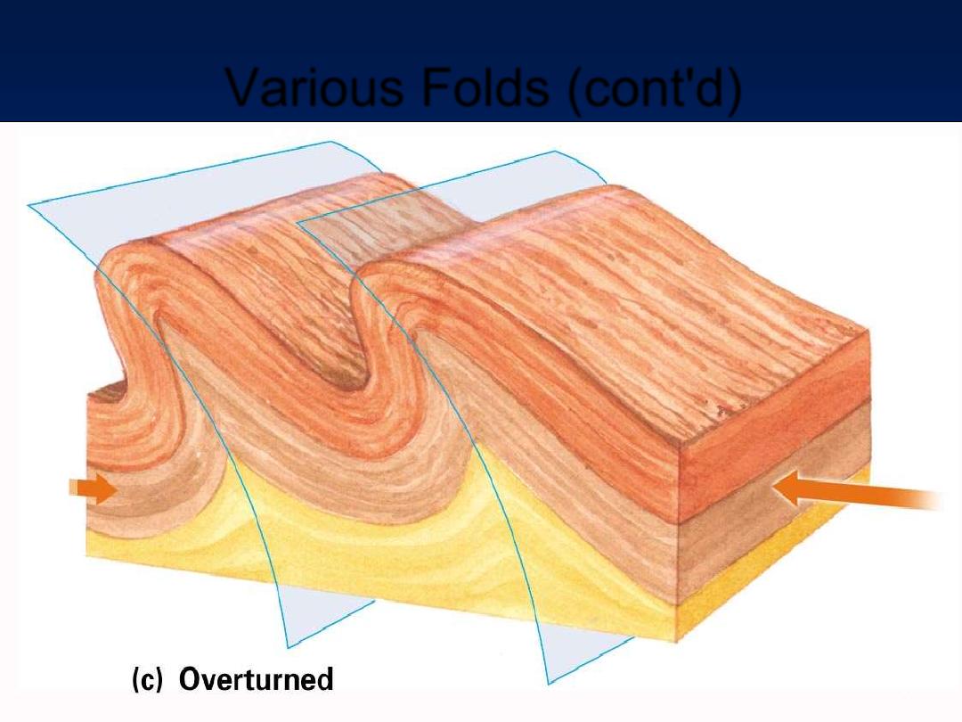
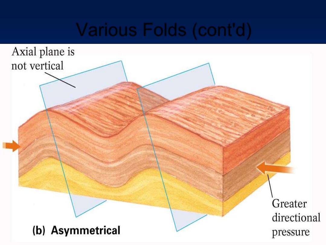
Various Folds (cont'd)
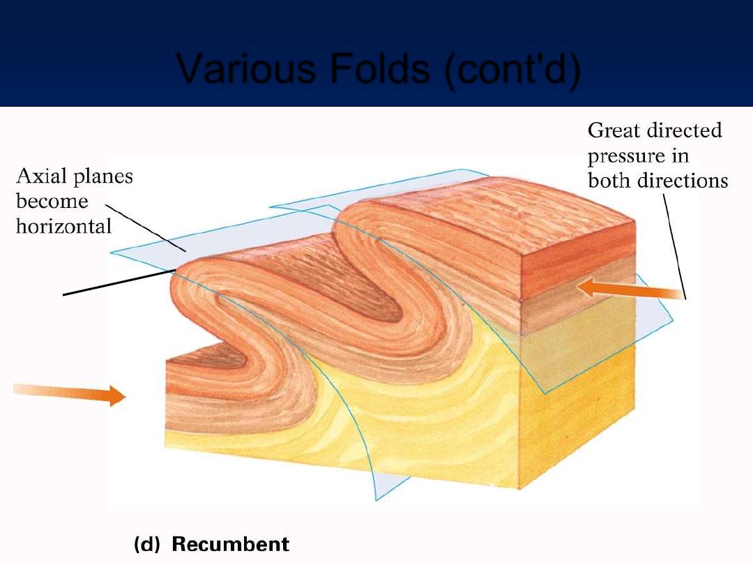
Various Folds (cont'd)
Axial plane near axis should be close to horizontal
Axis
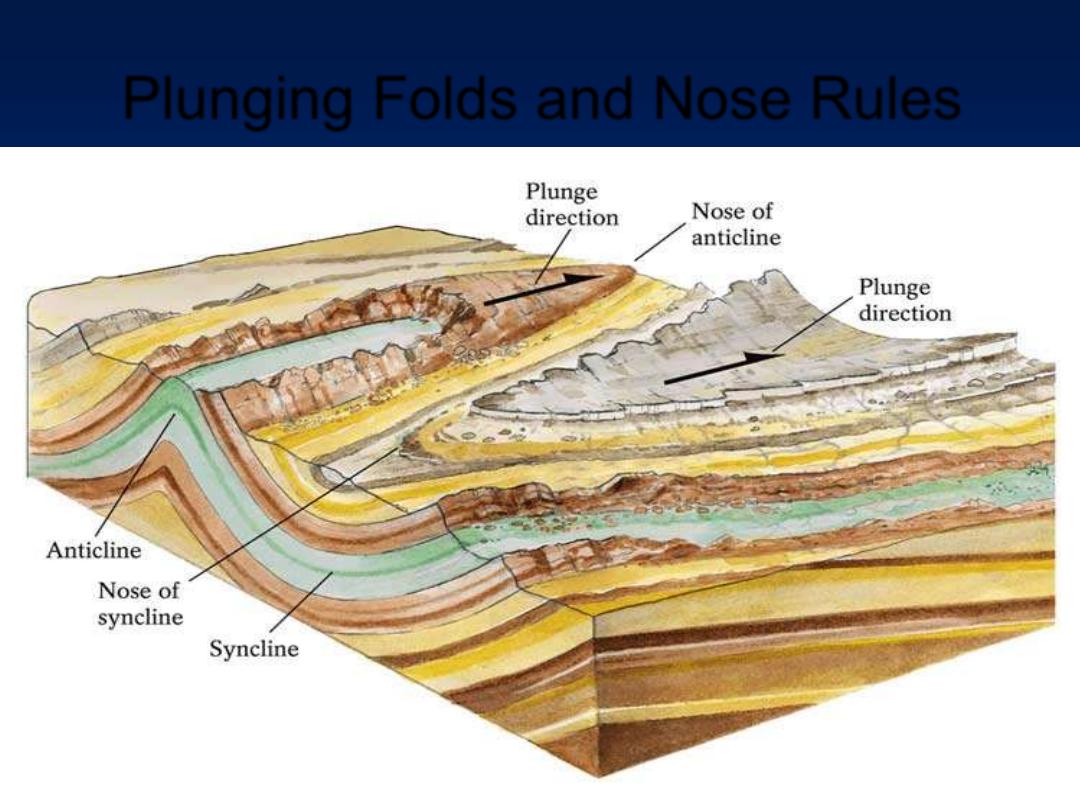
Plunging Folds and Nose Rules
Nose of anticline points direction of plunge, syncline nose in opposite direction
Up
End
Down
End
Demo: Plastic box, water, paper folds
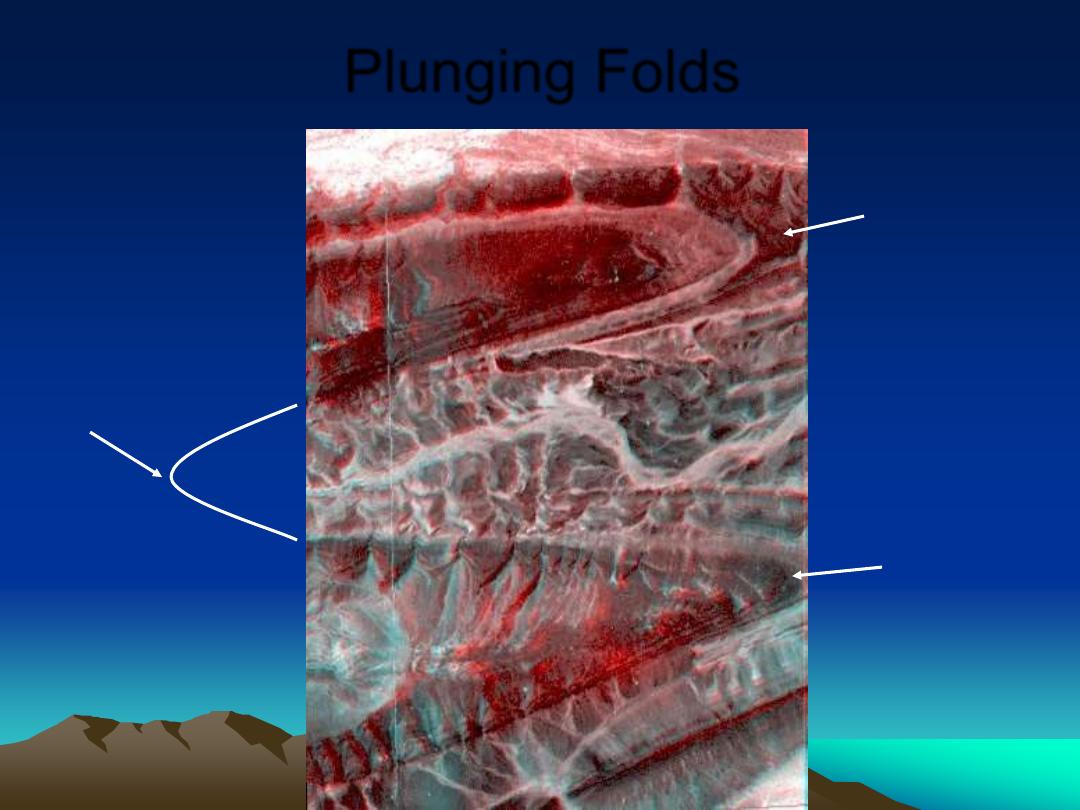
Plunging Folds
Nose
Nose
Nose
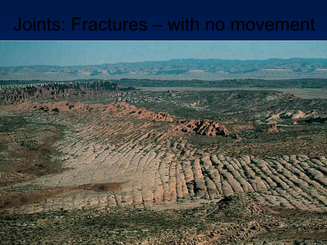
Joints: Fractures
– with no movement
Source: Martin G. Miller/Visuals Unlimited
vs. Faults with relative movement
Sandstone, note no streams here, too many cracks
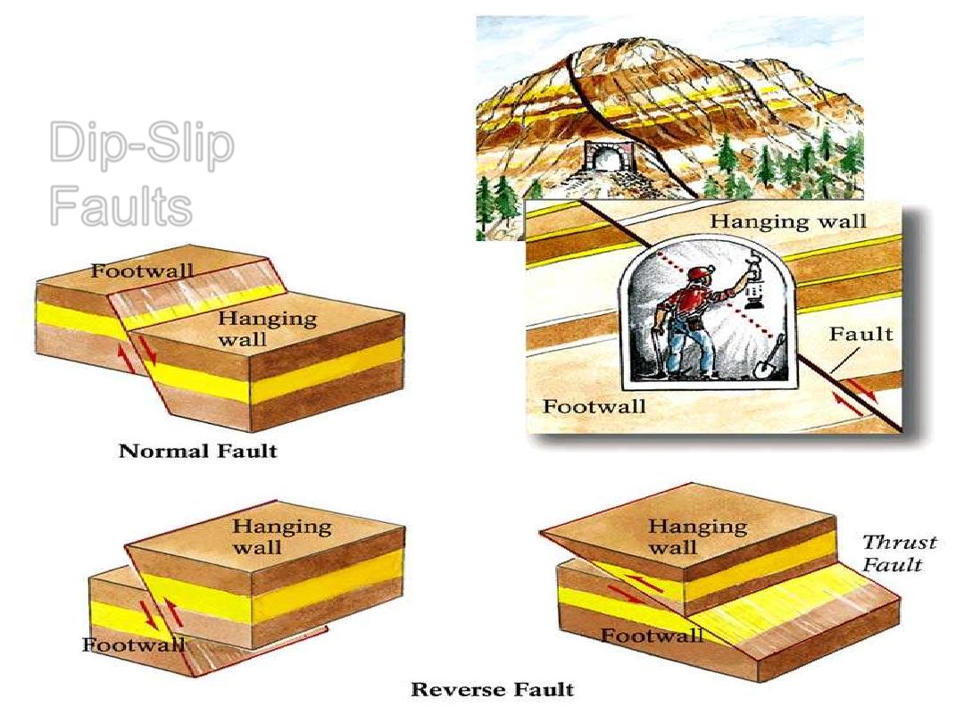
Dip-Slip
Faults
Demo: Cardboard Models
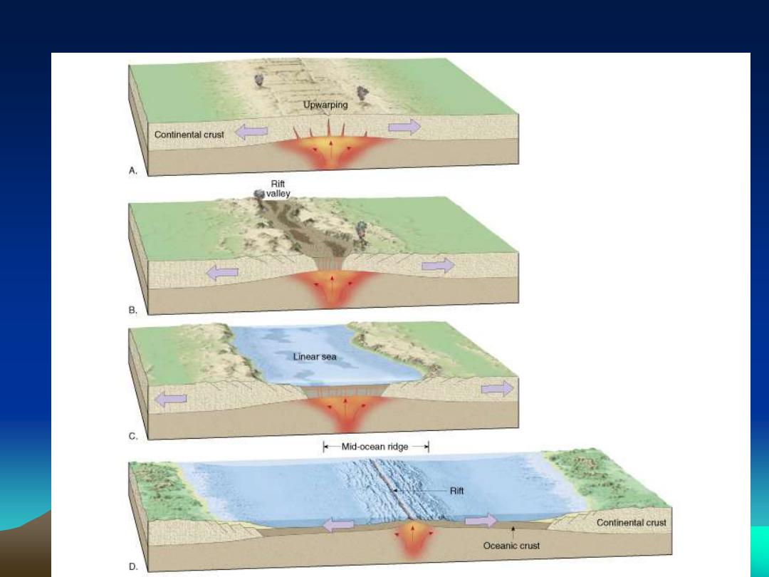
Continental Rift into Ocean Basin - Tension => Divergence
Rift Valleys and
Oceans are the
same thing
Normal Faults
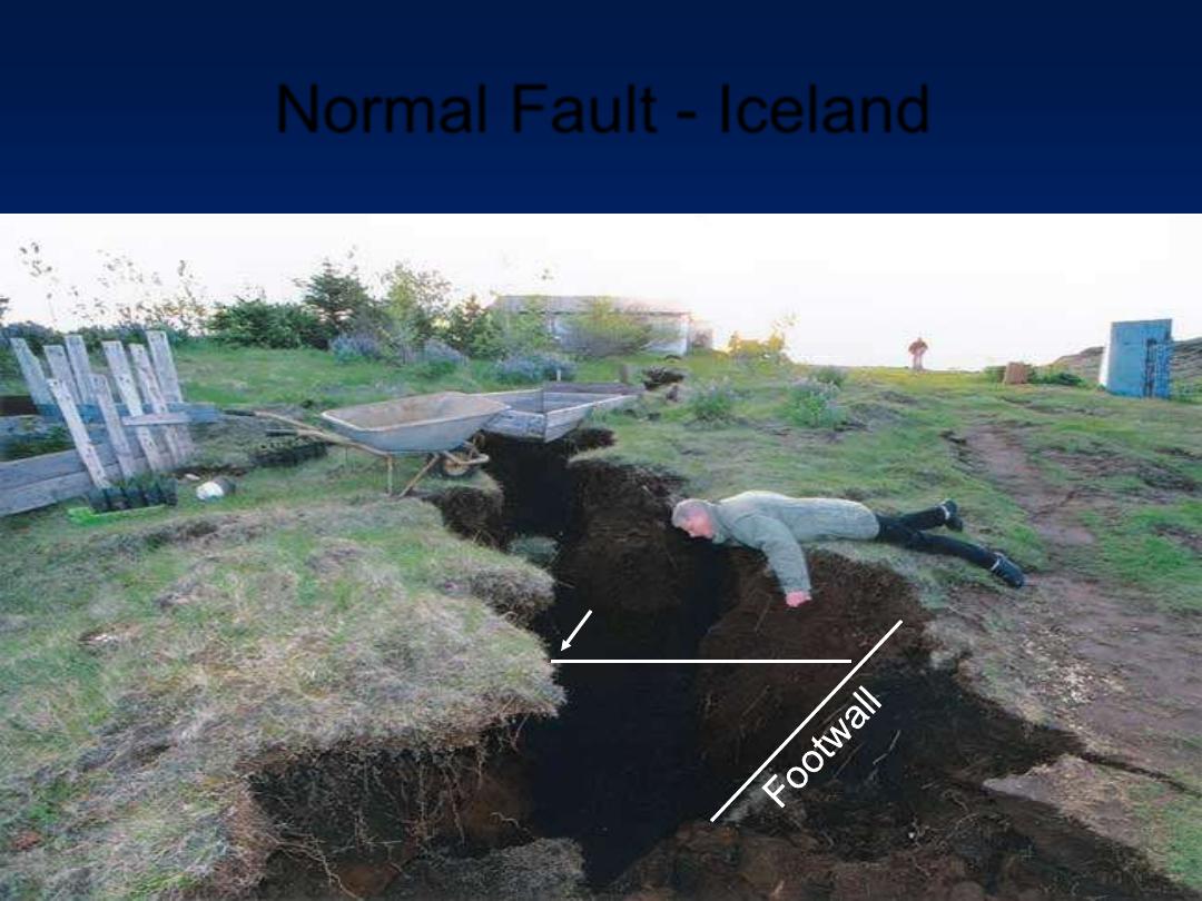
Normal Fault - Iceland
A new graben, down dropped hanging wall block - Normal Fault – divergent zone MOR
Overhanging
Block
Fault Line scarp
(High-angle
Normal Fault)
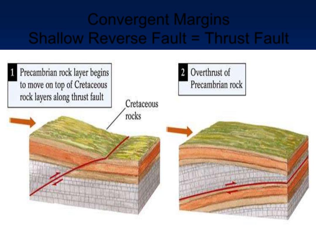
Convergent Margins
Shallow Reverse Fault = Thrust Fault
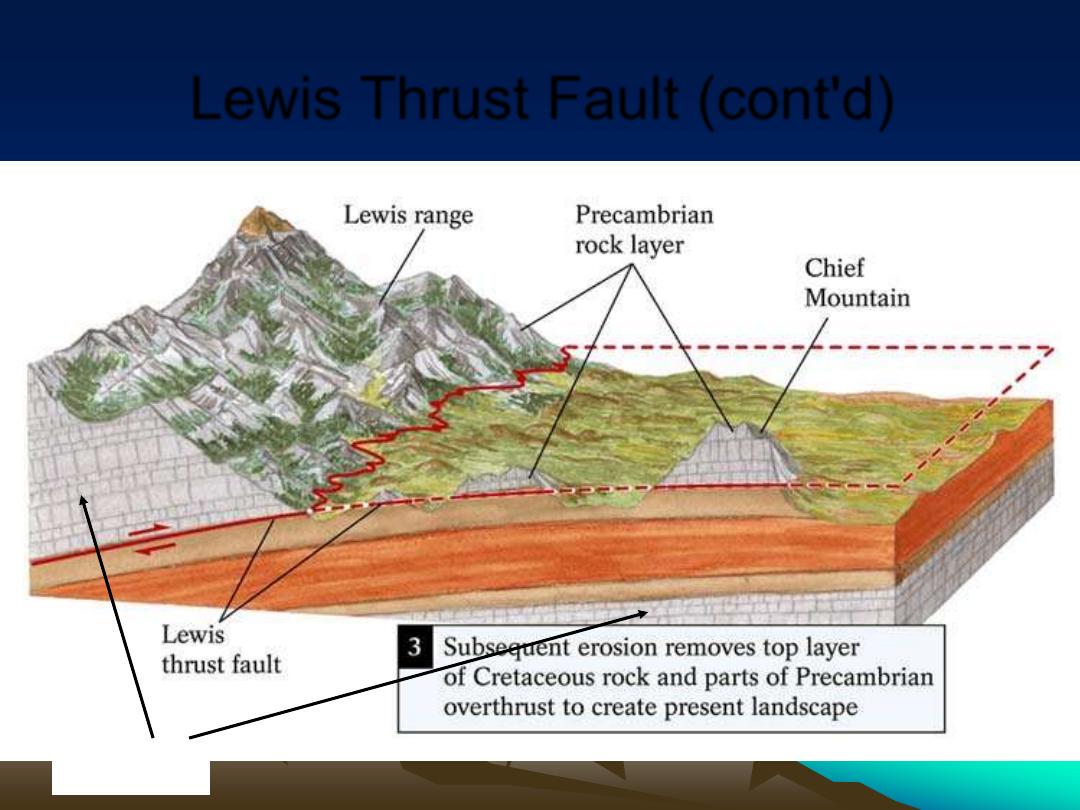
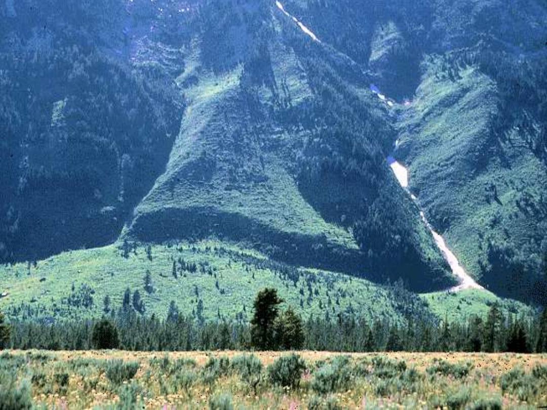
Lewis Thrust Fault (cont'd)
Same layer
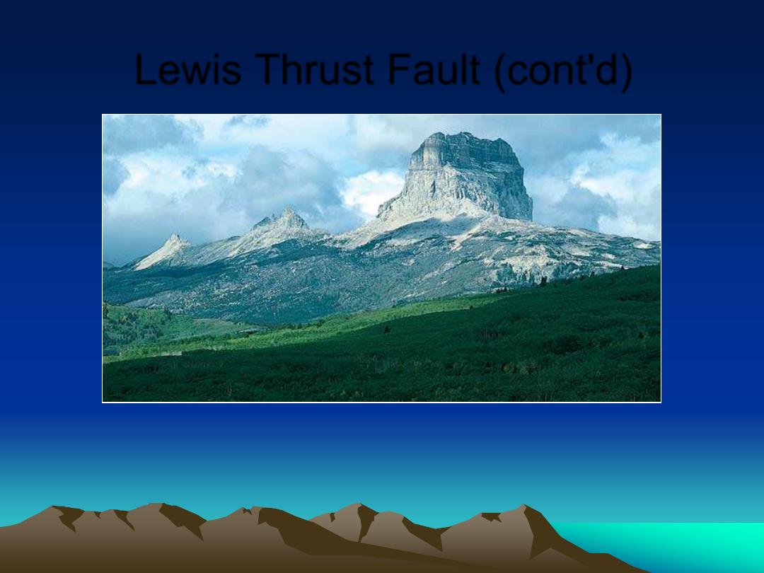
Lewis Thrust Fault (cont'd)
Source:
Breck P. Kent
PreCambrian Limestone over
Cretaceous Shales
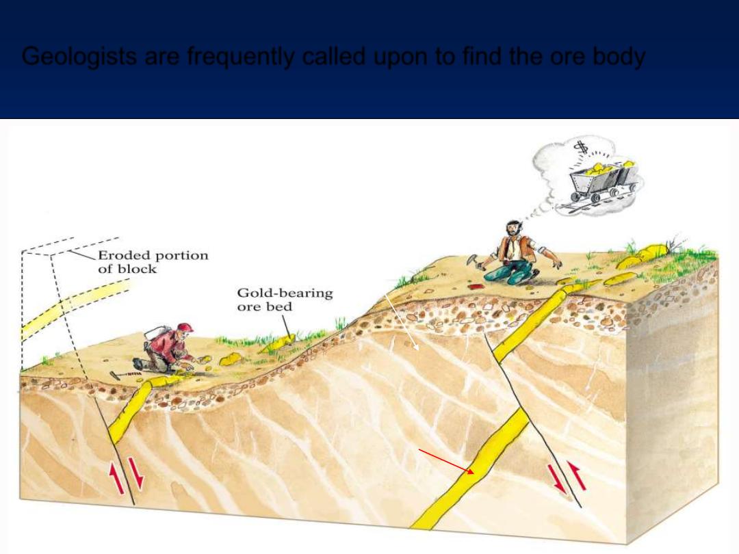
Geologists are frequently called upon to find the ore body
Younger
Miners pay geologists to
find their lost orebody
One friend earned
enough to buy a house
This poor guy is out of luck
What phase of magma fractionation would result in the
placement of this ore body?
Which formed first, the ore body or the fault?
What common mineral is mostly likely in the ore body?
This
guy is
rich
Normal
Reverse
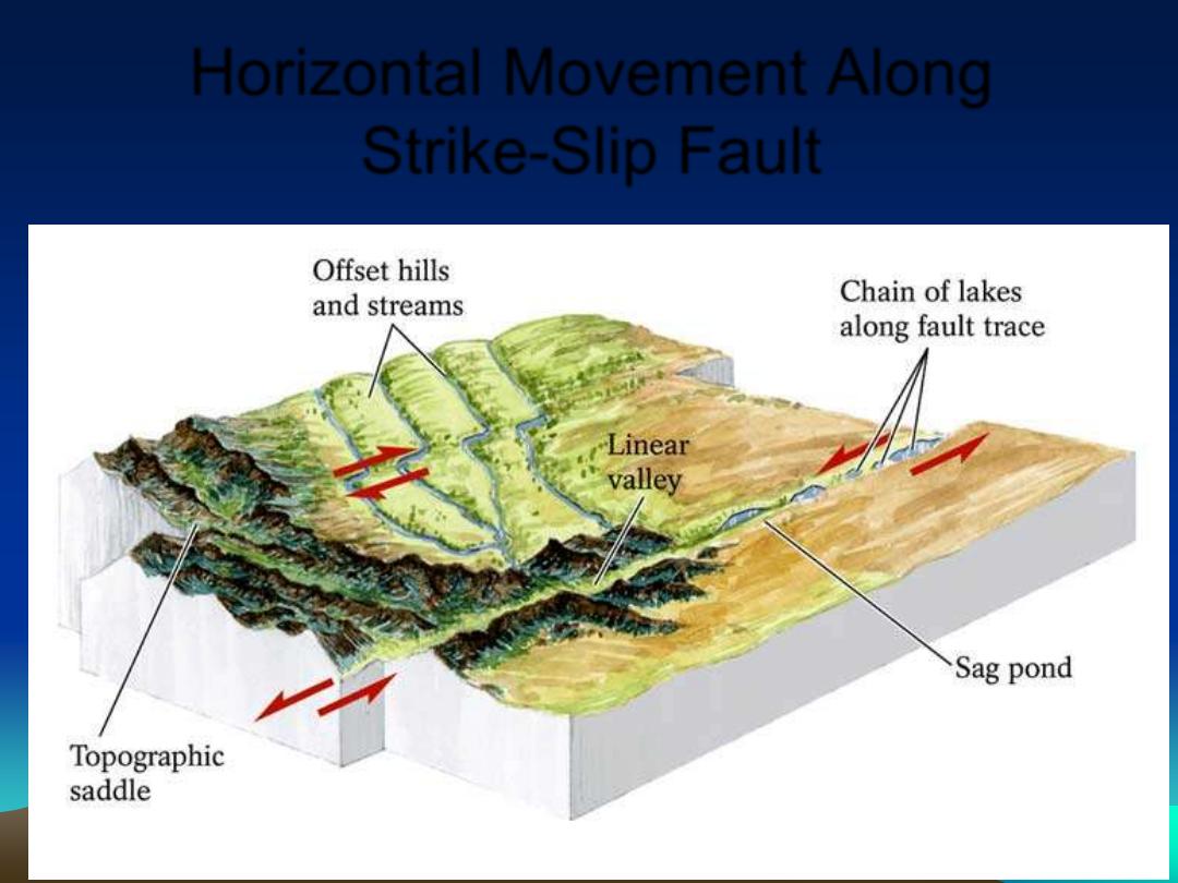
Horizontal Movement Along
Strike-Slip Fault
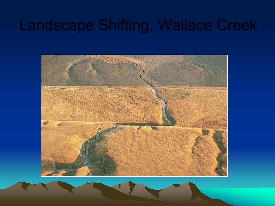
Landscape Shifting, Wallace Creek
San Andreas Fault
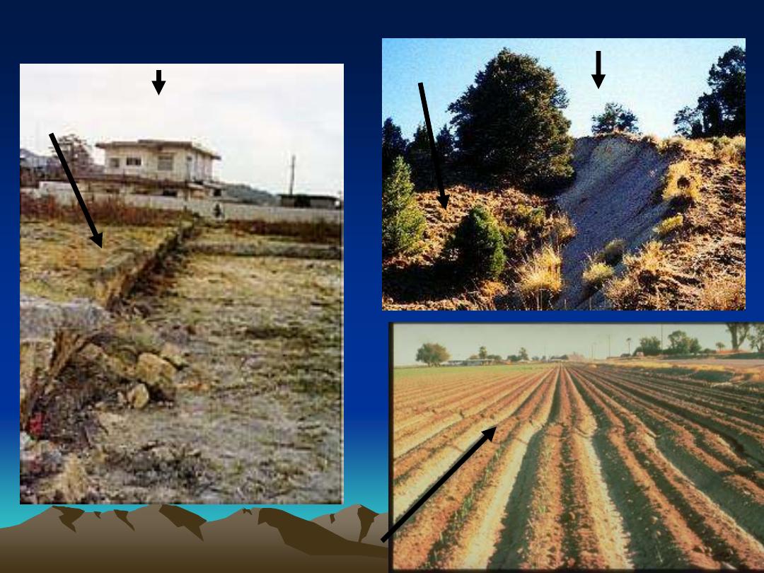
Normal Fault Quake - Nevada
Reverse Fault Quake - Japan
Strike Slip Fault Quake - California
HW Down
HW Up
Convergent
Divergent
Transform
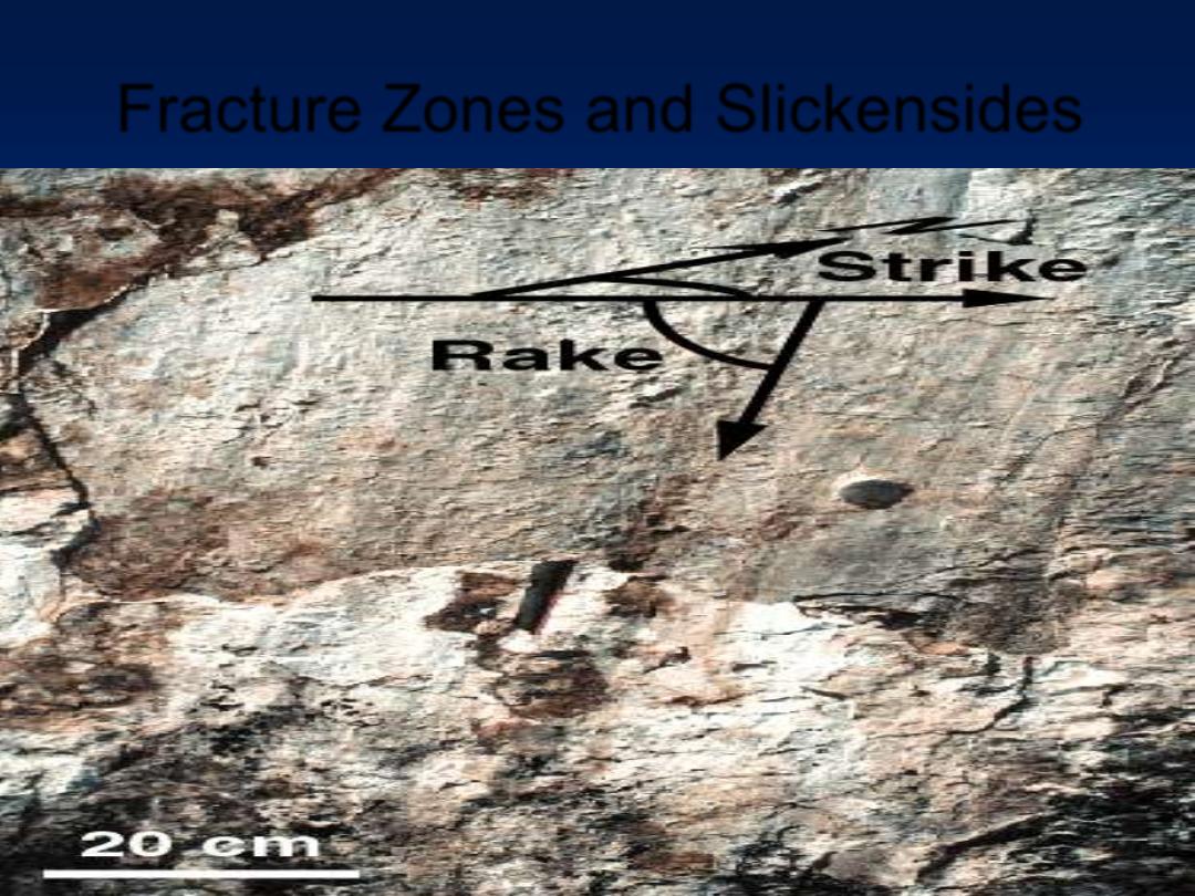
Fracture Zones and Slickensides
http://pangea.stanford.edu/~laurent/english/research/Slickensides.gif