
Important Fluvial Terms
Drainage basin/catchment/watershed:
•defined by the ridges that control the direction of precipitation
drainage. Every stream has a drainage basin.
•A drainage basin collects water, which is delivered to a
larger basin, creating larger streams
Continental Divide:
•The line separating subcontinental-scale drainage basins
Water and sediment usually terminate in oceans
Internal drainage basins are areas in which water does not
terminate in an ocean. (leaves via evaporation or subsurface
gravitational drainage
http://atlas.gc.ca/site/english/maps/freshwater/distribution/drainage
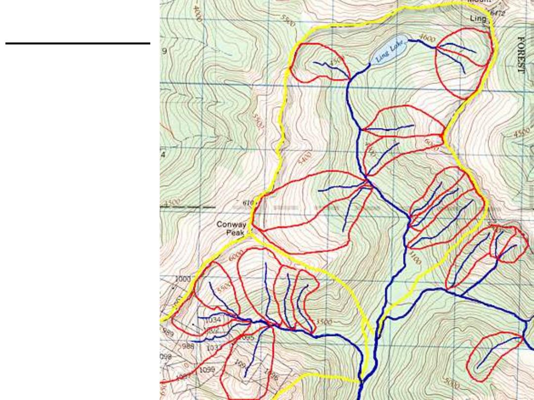
Drainage Basins
Red:
selected
drainage
basins for first
order streams
(collection of
red areas should
fill the yellow
area but some
streams not
represented)
Yellow:
larger drainage
basins for river

Drainage density is determined by dividing the total
length of all streams by the area of the basin
For a given surface, a higher drainage density is generally
found in a humid area than in a dry area
Drainage Pattern is the arrangement of channels in an
area. Drainage pattern is determined by:
•Slope of the catchment
•Rock resistance to weathering
•Climate
•Underlying bedrock
•Subsurface hydrology
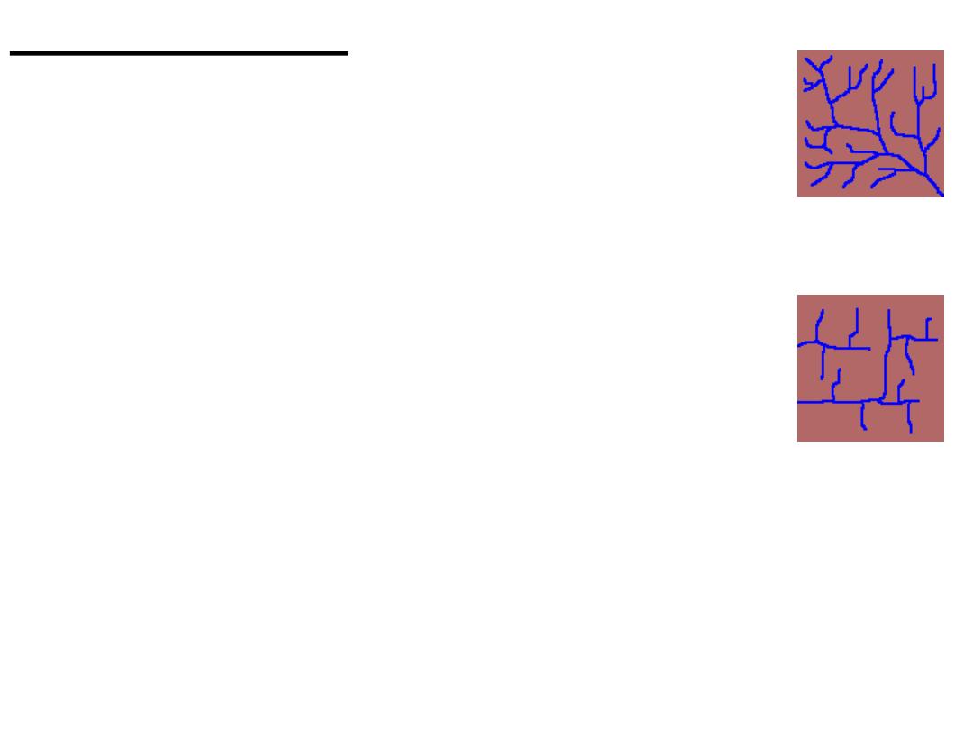
Drainage Patterns
1.
Dendritic
Tree-like pattern
2.
Rectangular
A faulted and jointed landscape directs streams
along right angle turns
3.
Trellis
Forms where resistance of bedrock varies
or along a folded landscape
Folds create parallel large streams, capturing
runoff from smaller streams and joining into
larger rivers at right angles

4.
Radial Drainage
Streams flow from central peak or dome
5.
Annular Drainage
Occurs in dome structures with
concentric patterns of rock strata
6.
Parallel drainage
Steep slopes - similar to dendritic,
but steep slopes cause branches to
appear almost parallel to one another
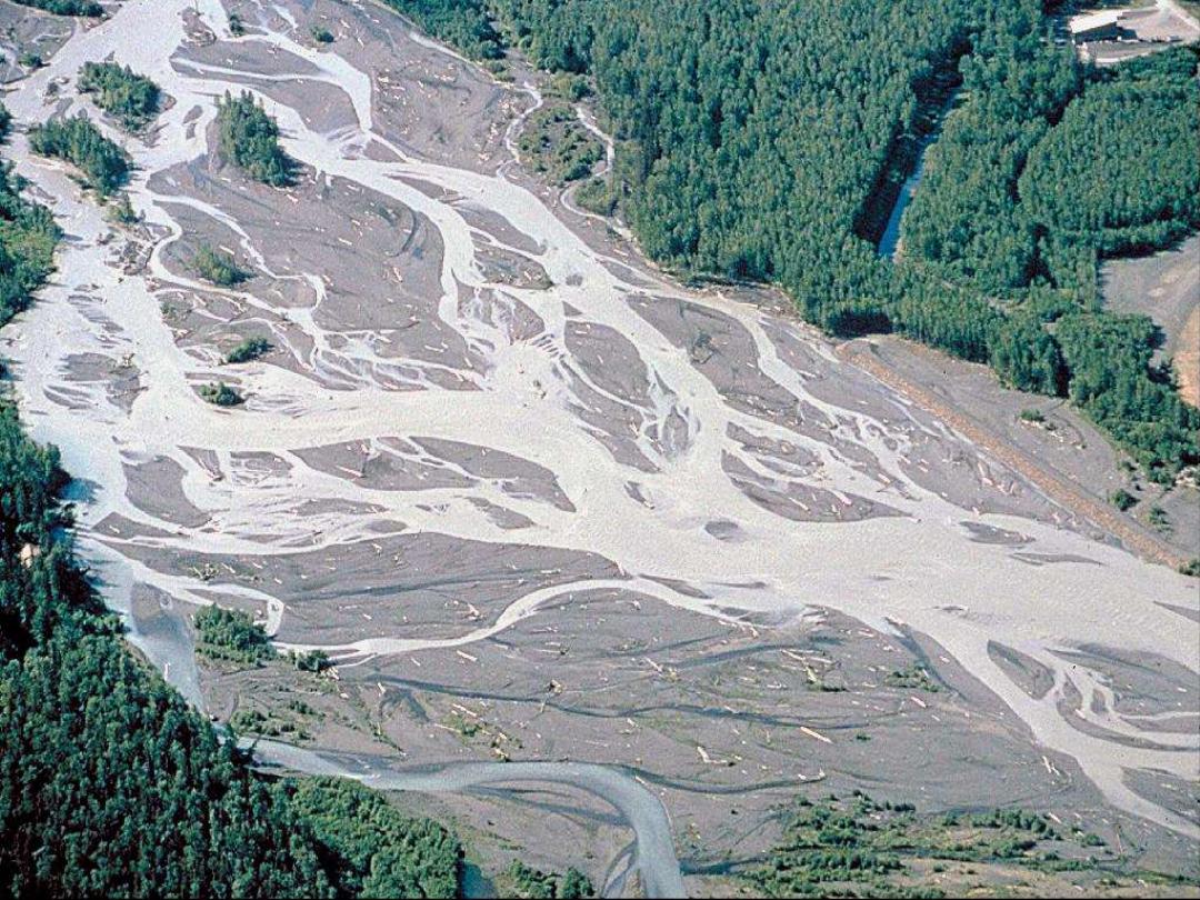
Braided stream, S. Alaska
Photo: M. Miller (U. Oregon)
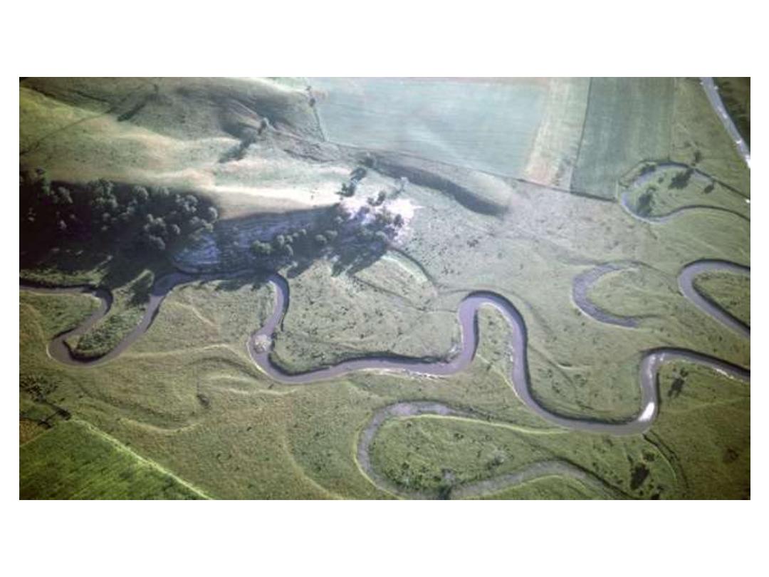
Meandering Stream
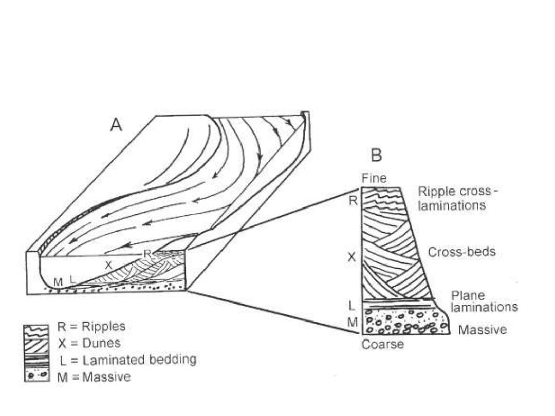
As this stream meanders, the bend seen in cross-section A extends
further to the left. As this occurs, there is a transition from erosional,
supercritical flows to critical and subcritical flow, with the associated
depositional features superimposed as in cross-section B.
*Note: Plane beds and antidunes are only
formed when flows are charged to capacity.

Oxbow lake
A lake that was formerly a channel of a meandering stream
Formed when a meandering stream erodes back upon
itself, straightening the main channel. The old river channel
is still filled with water until sedimentation fills it again
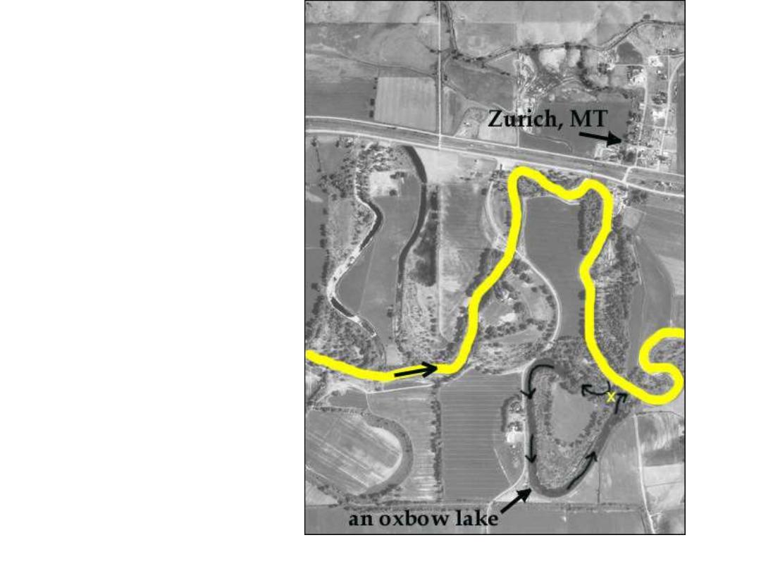
Oxbow Lake,
Milk River, MT
(just south of
Canadian border)

Stream gradient
A stream usually has a steeper slope upstream and a
gentler slope downstream, resulting in an uneven, concave
shape
Nickpoint
A nickpoint is the location at which an abrupt change in
stream gradient occurs
Waterfall
At a nickpoint, the water falls to softer, more easily
erosive rock strata, leading to undercutting

Floodplains
Flat, low-lying areas near a river that are repeatedly flooded.
Rivers overflow during high flow and deposit sediment
upon the floodplain.
Rivers of a floodplain are generally embedded within the
sediment of the floodplain itself.
Levees develop along the banks of rivers as a result of
flooding. When a river floods, the velocity is reduced
beyond the bank, leading to sedimentation. The larger
particles fall first, leading to the creation of a natural levee.
The river may rise relative to the floodplain, leading to
backswamp areas.

Terraces
Uplift may allow a stream to cut deeper into its own
floodplain (rejuvenation), leading to alluvial terraces.
Such terraces look like steps above the river (Fig. 11-19)
River Deltas
The velocity of a river rapidly decelerates as it reaches
a large body of water. This leads to deposition, of
progressively smaller particles (large ones first). A
characteristic triangular shape forms (hence the term delta)
The river channels divide into smaller ones in all the
sediment, leading to what appears to be a reversed
dendritic drainage pattern (braided delta).
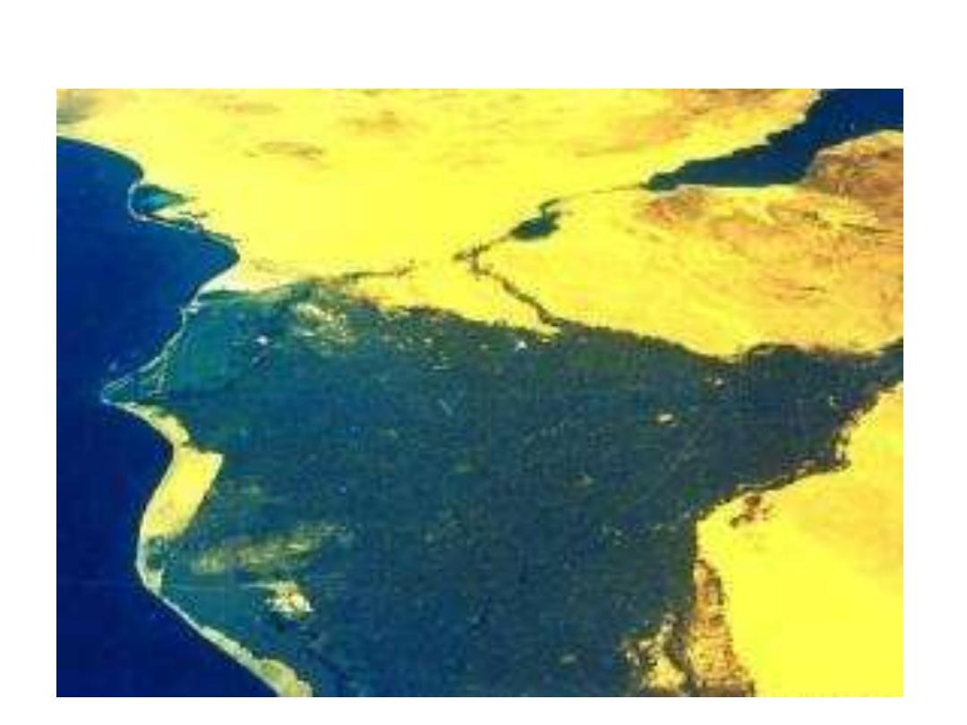
Nile River Delta