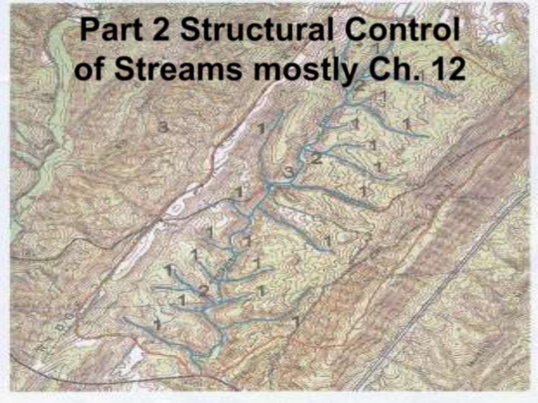
Part 2 Structural Control
of Streams mostly Ch. 12
•
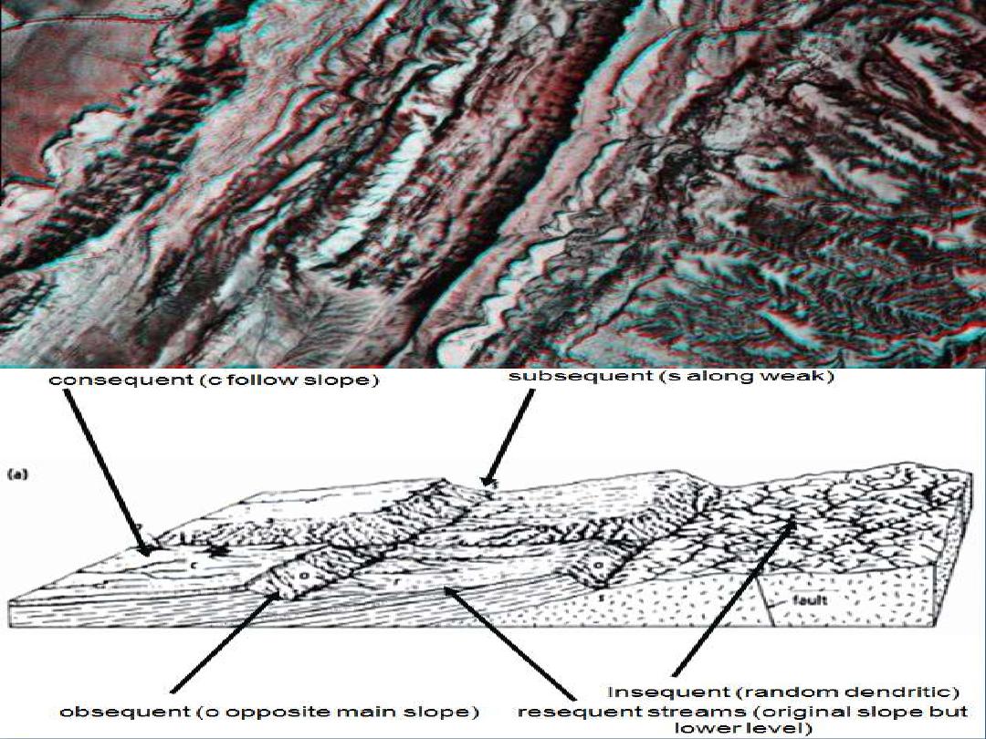
Consequent streams follow slope of the land
over which they originally formed.
•
Subsequent streams are streams whose course
has been determined by erosion along weak
strata.
•
Resequent streams are streams whose course
follows the original relief, but at a lower level
than the original slope
•
Obsequent streams are streams flowing in the
opposite direction of the consequent drainage.
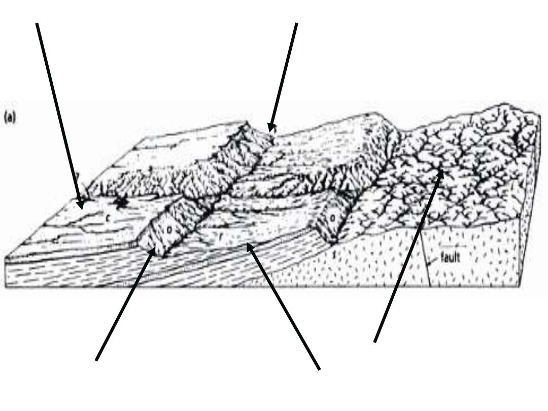
consequent (c follow slope)
subsequent (s along weak)
obsequent (o opposite main slope)
resequent streams (original slope but
lower level)
Insequent (random dendritic)
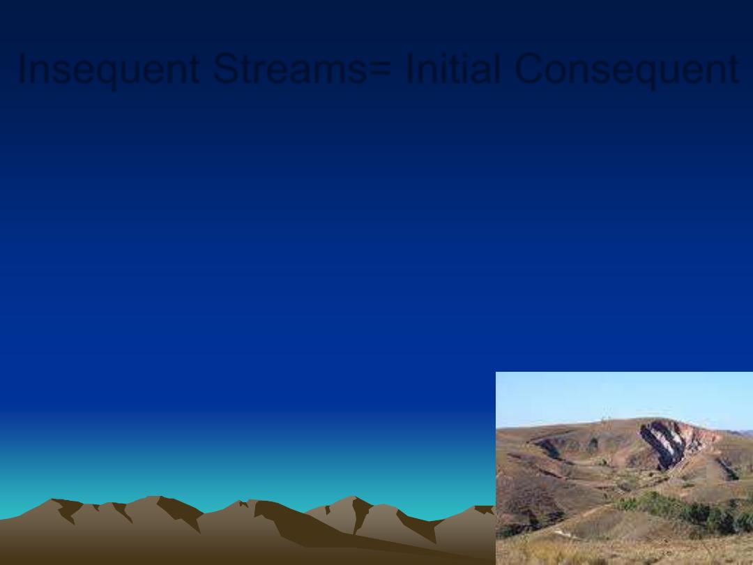
Insequent Streams= Initial Consequent
•
Almost random drainage often forming dendritic
patterns.
•
Typically tributaries - developed by headward
erosion on a horizontally stratified rocks, or a
substrate with ~ constant composition.
•
NOT controlled by the original slope of the
surface, its structure or the type of rock.
Headward Erosion
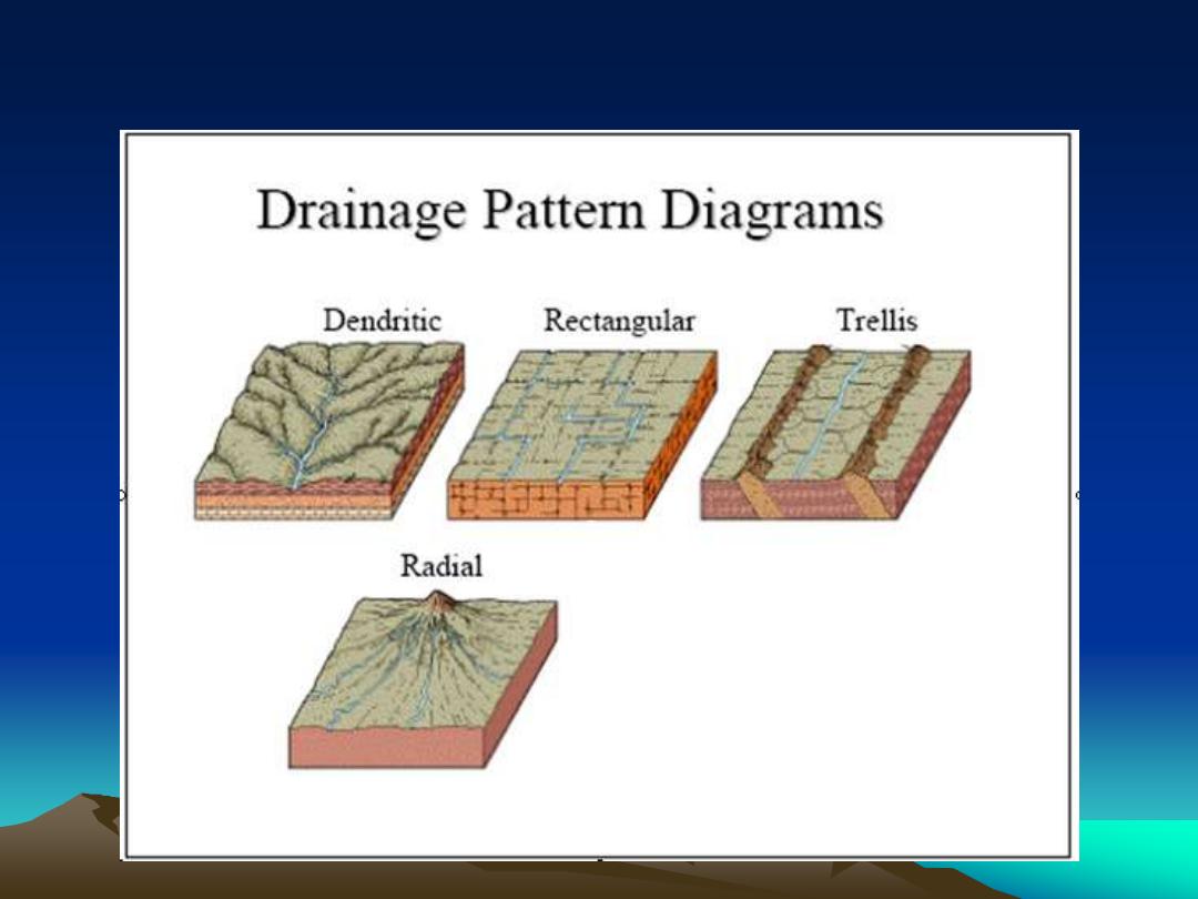
Drainage Patterns with and without structural control
None Joints fold limbs
Volcano, exposed pluton, diapir
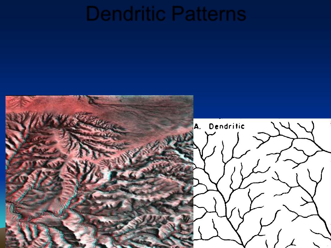
Dendritic Patterns
•
Underlying bedrock has no structural control
over where the water flows.
•
Characteristic acute angles
•
No repeating pattern.
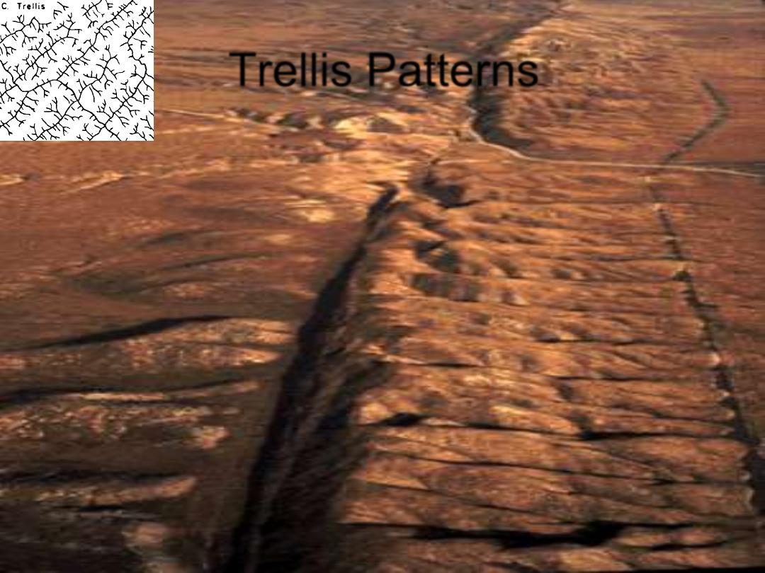
Trellis Patterns
•
Form where underlying bedrock has
repeating weaker and stronger types of
rock.
•
Streams cut down deeper into the weaker
bedrock
•
Nearly parallel streams
•
Branch at higher angles.
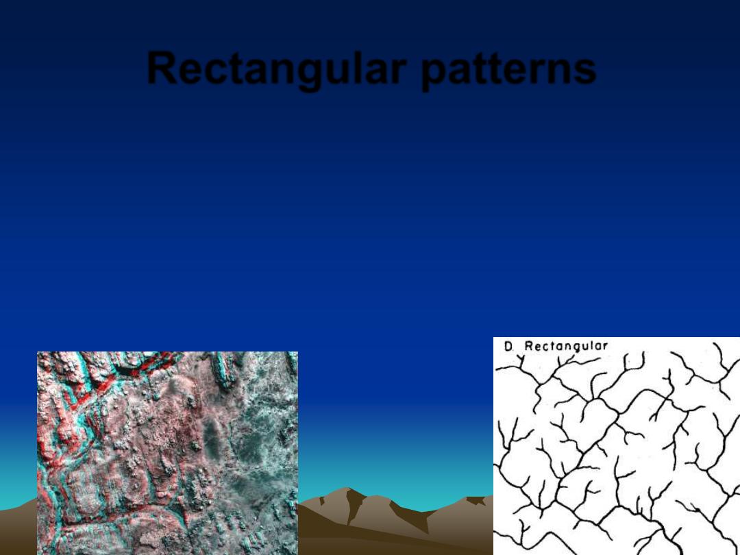
Rectangular patterns
•
Branching of tributaries at nearly right
angles
•
Form in jointed igneous rocks or horizontal
sedimentary beds with well-developed
jointing or intersecting faults.
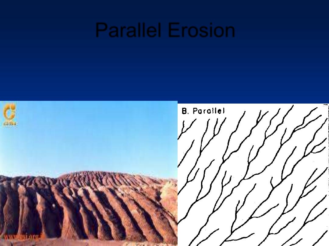
Parallel Erosion
•
Form on unidirectional regional slope or parallel
landform features. Small areas.
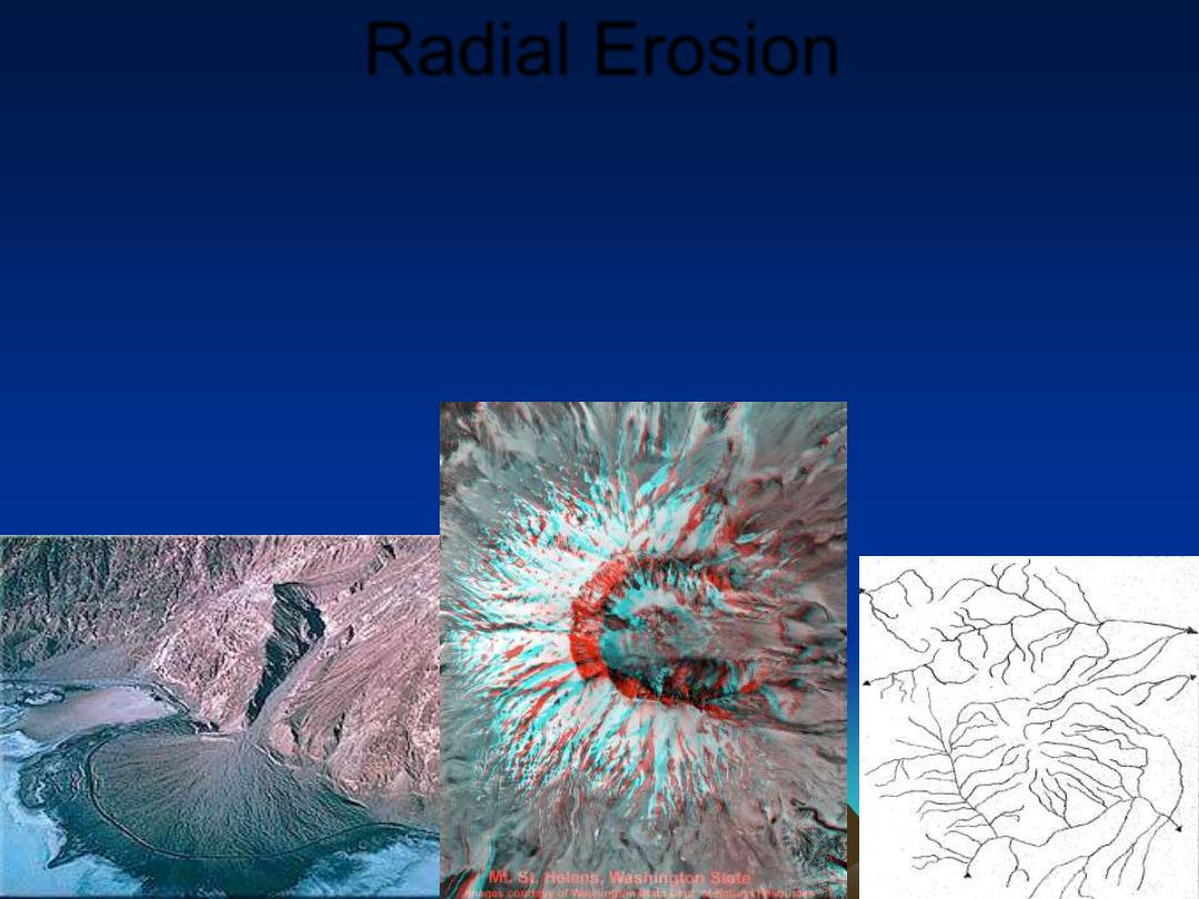
Radial Erosion
•
Flow of water outward from a high point
•
Down a volcano cone
•
or an intrusive dome, or
•
down an alluvial fan.
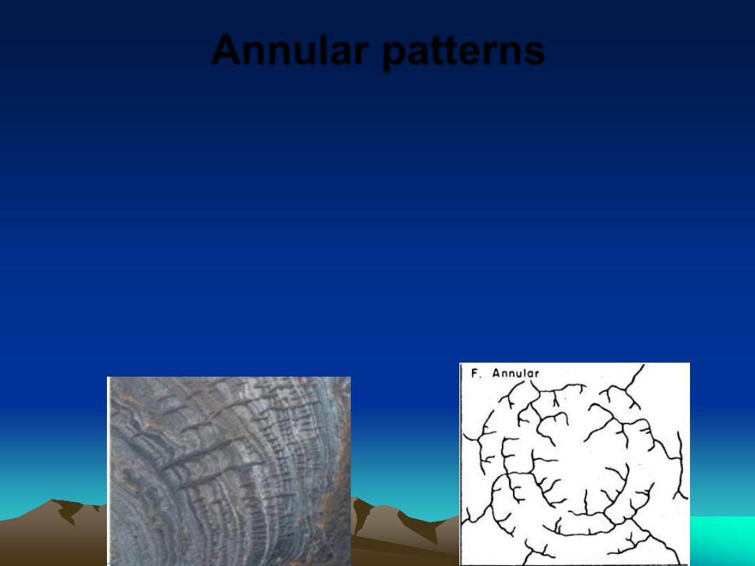
Annular patterns
•
form on domes of alternating weak and
hard bedrocks.
•
The pattern formed is similar to that of a
bull's-eye when viewed from above
•
weaker bedrocks are eroded and the
harder are left in place.
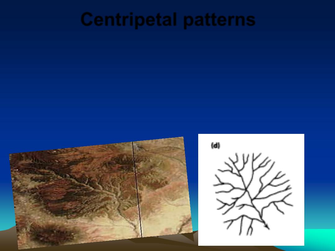
Centripetal patterns
•
Form where water flows into a central location,
such as a round bowl-shaped watershed, or a
karst limestone terrain where disappearing
streams flow down into a sinkhole and then
underground.
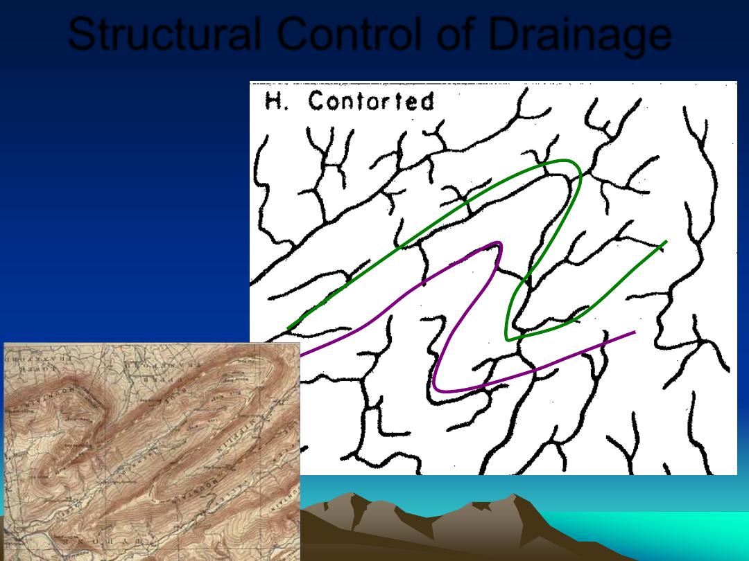
Structural Control of Drainage
•
Contorted
Folded Rocks
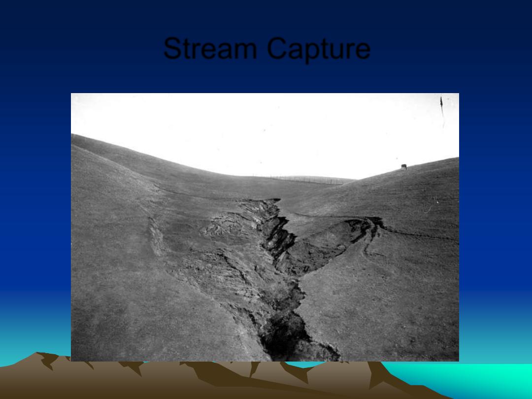
Stream Capture
Headward Erosion
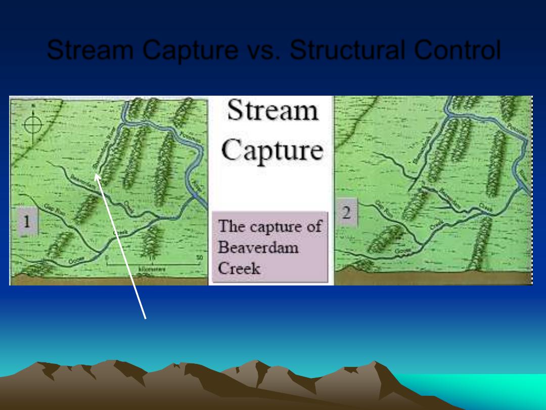
Stream Capture vs. Structural Control
Subsequent Susquehanna
does not reach Beaverdam
Creek flowing through
water gap
Susquehanna captures
headwaters of Beaverdam
Creek, diverting upper
Beaverdam trunk to
Susquehanna channel.
Godfrey Ridge
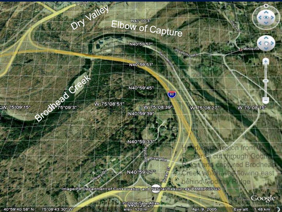
Stream Capture
Headward erosion from Water
Gap area cut through Godfrey
Ridge and captured Brodhead
Creek which was flowing east
behind Godfrey Ridge
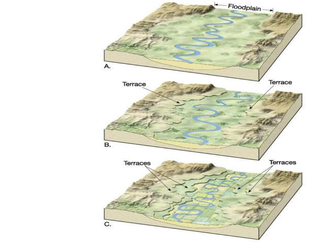
1. Old river meanders
across floodplain
2. Base level drops
(how?), or region
uplifts. Area now
much higher above
sea level than before.
Potential energy
increases, water flows
faster, better erosion,
stream straightens and
cut down to base
level, less floodplain
width and cut lower.
3.Terrace forms from
previous floodplain.
Further incision cuts
another terrace
Terraces 1
Next time Terraces 2 and 3:
Isostatic Rebound and high
water shorelines as glaciers
melt
Potential
r
gh to Kinetic Energy
1/2
mV
2
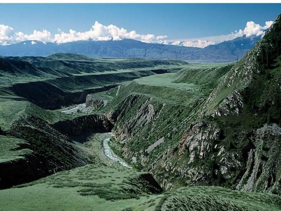
A flight of river terraces
•
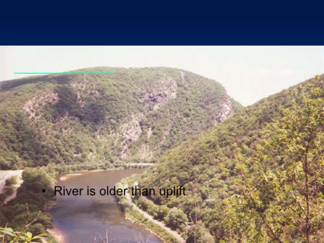
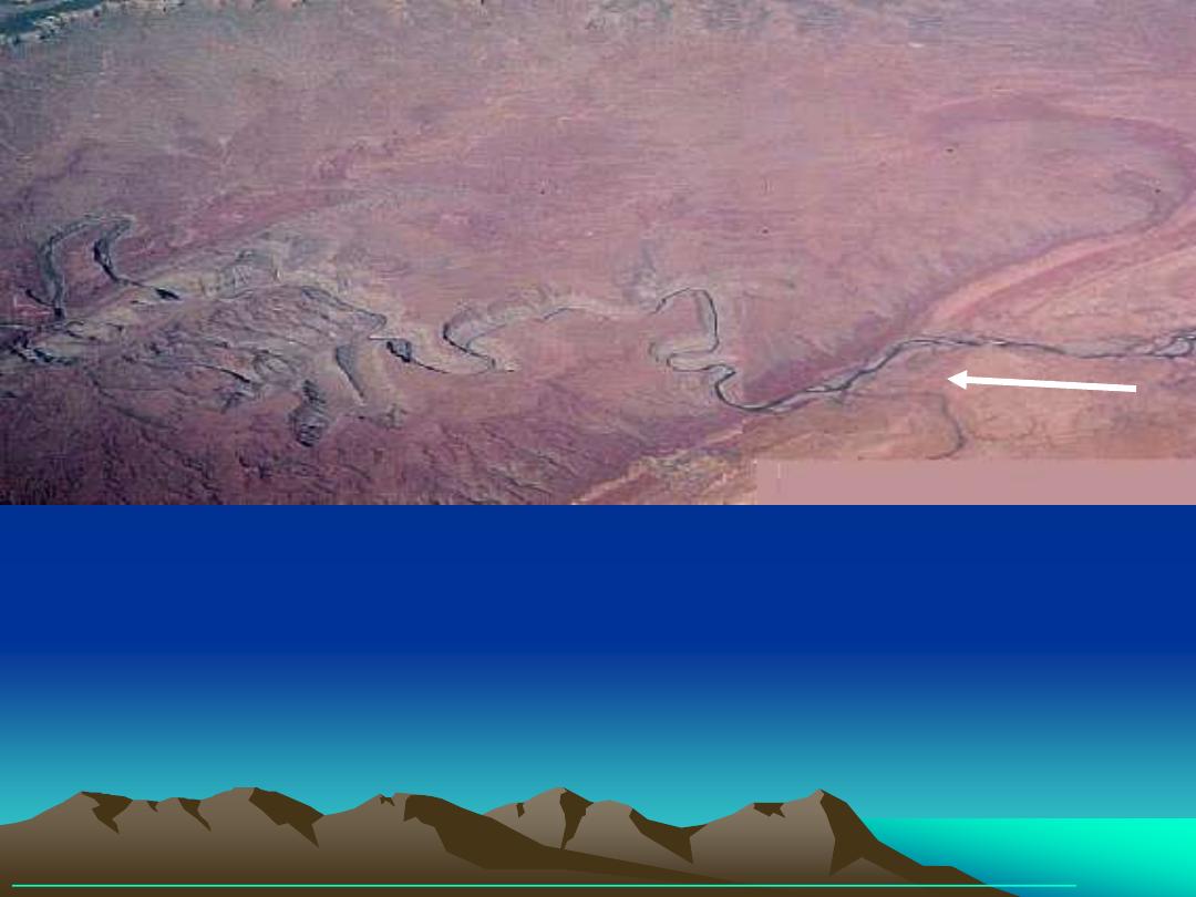
Antecedent Streams and Superimposed Streams
•
Meanders in steep, narrow valleys
– Caused by a drop in base level or uplift of region
•
River is older than uplift
Incised (entrenched) meanders
"In this panorama in southwestern Colorado, a stream flows from the right
across an uplift (anticline) in the rocks. As soon as the stream enters the uplift,
its canyon becomes deep. Note the entrenched [incised] meanders, a couple of
which were cut through and abandoned when the canyon was about half its
present depth. As soon as the river exits the uplift, the canyon once again
becomes shallow. Clearly, the river was there first and the rocks arched upward
across its course." Steve Dutch
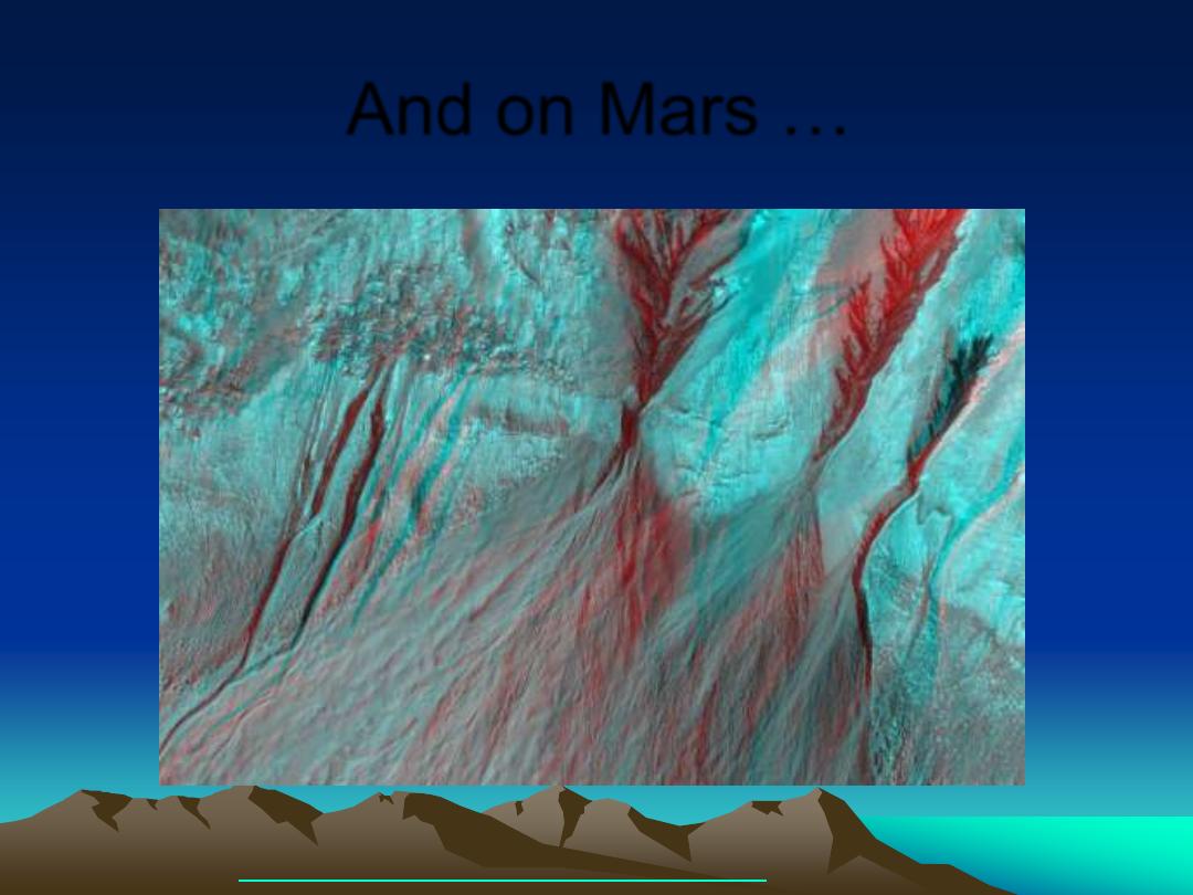
Some photos in this PowerPoint made available online, courtesy of Steve Dutch, click here
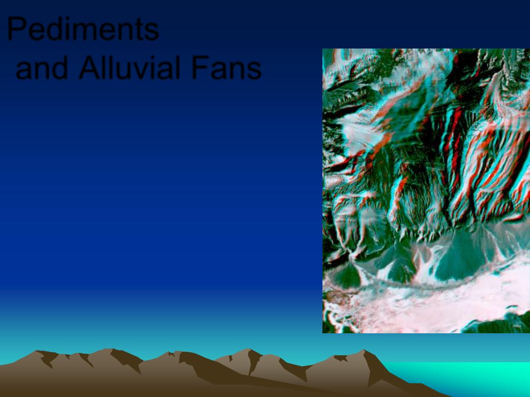
Pediments
and Alluvial Fans
Alluvial fans typically develop at the
exits of intermittent streams
draining arid mountainous regions.
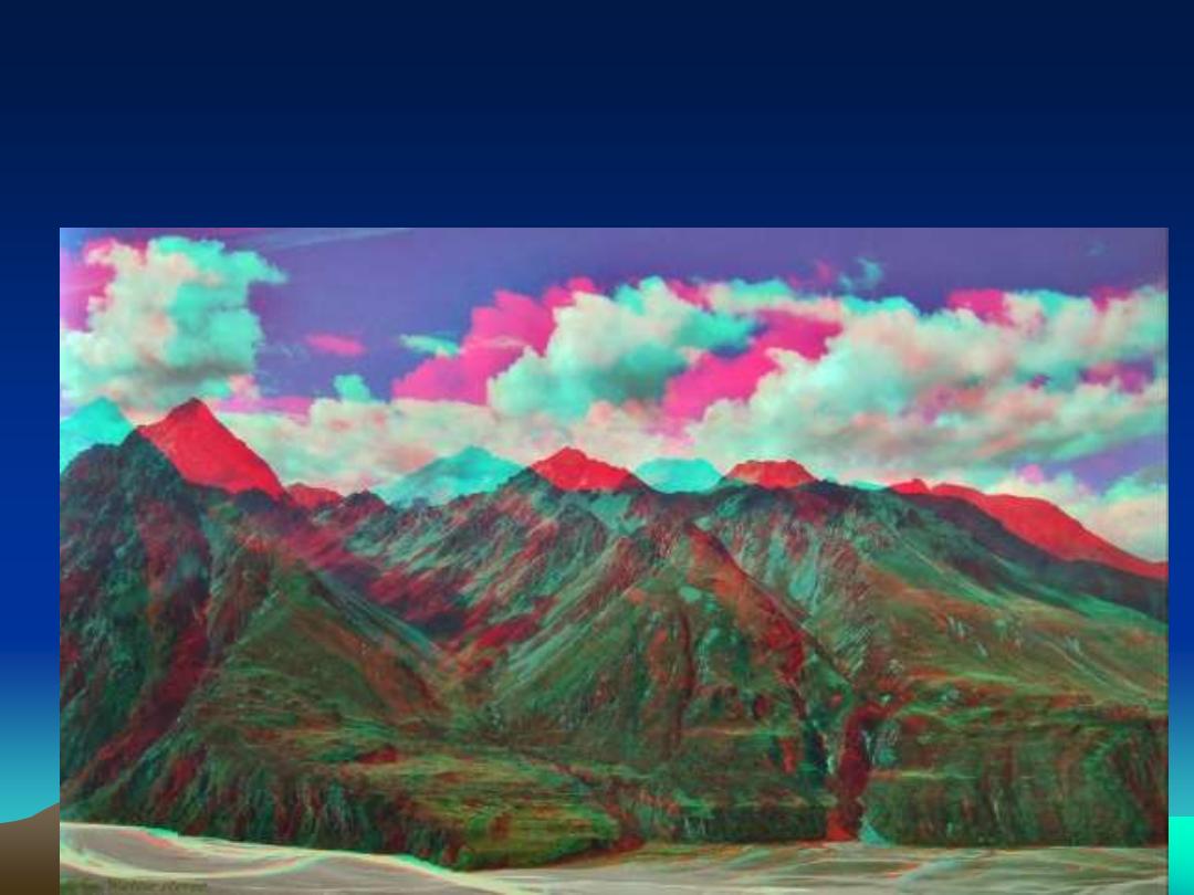
An example of a v-shaped stream, with fairly constant
slope and cross section
Conservation of Energy with frictional losses
•
A stream channel has been uplifted to 300
meters above base level. It
’s cross sectional
area, slope, and water depth is close to
constant. The stream is full of large boulders. At
300 meters it flows out of an alpine lake, where it
has an average velocity of 0.01 meters/sec, that
is, it has mostly potential energy. At base level it
has a velocity of 15 meters per second (so all
kinetic energy, plus frictional losses on the way
down. Estimate the percent energy lost to
friction.
An example for the homework calc.
25
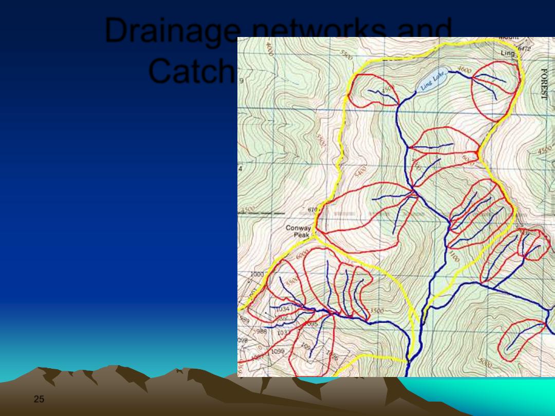
Drainage networks and
Catchment Areas
•
By mapping local
maxima (divides) in
topography, natural
terrains can always be
divided, at all scales
(from meters to 1000
km), into catchment
areas, each exited by
one principal drainage,
into which surface
runoff is channeled
•
This is not a necessary
property of any
surface
…it is the result
of processes that act
to shape the
landscape