
Introduction to Aerial
Photography Interpretation
*DRAFT*
History of Aerial Photography
1858 - Gasparchard Tournachon
photographs Bievre (outside
Paris) from a balloon
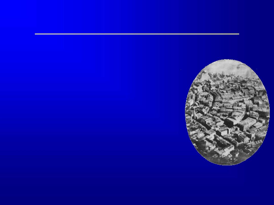
1860 - James Black photographs
Boston Harbor from a tethered
balloon (earliest existing -
perhaps first in US)
Boston Harbor 1860
History of Aerial Photography
US Civil War - Union General
George McClellen photographs
confederate troop positions in VA.
1882 - E.D. Archibald, British
Meterologist takes first kite
photograph
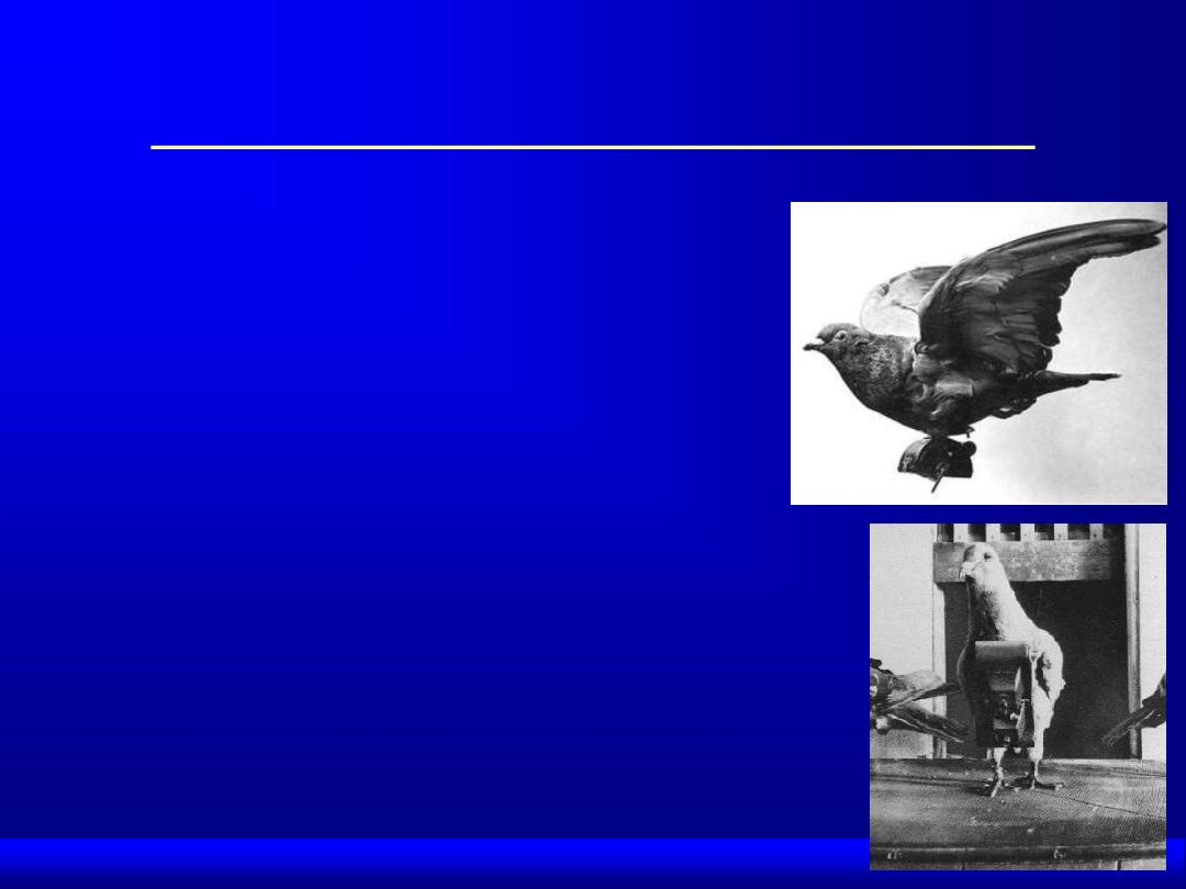
1903 - Pigeon cameras
1906 - George Lawrence
photographs San Francisco after
great earthquake and fire
History of Aerial
Photography
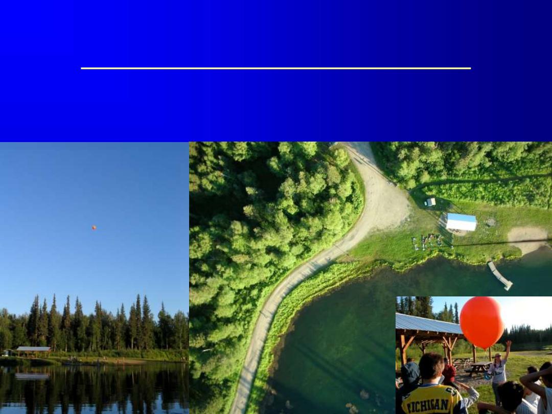
2006 - Effie Kokrine Charer School Students take
digital “flotographs” at Twin Bears Camp, Alaska
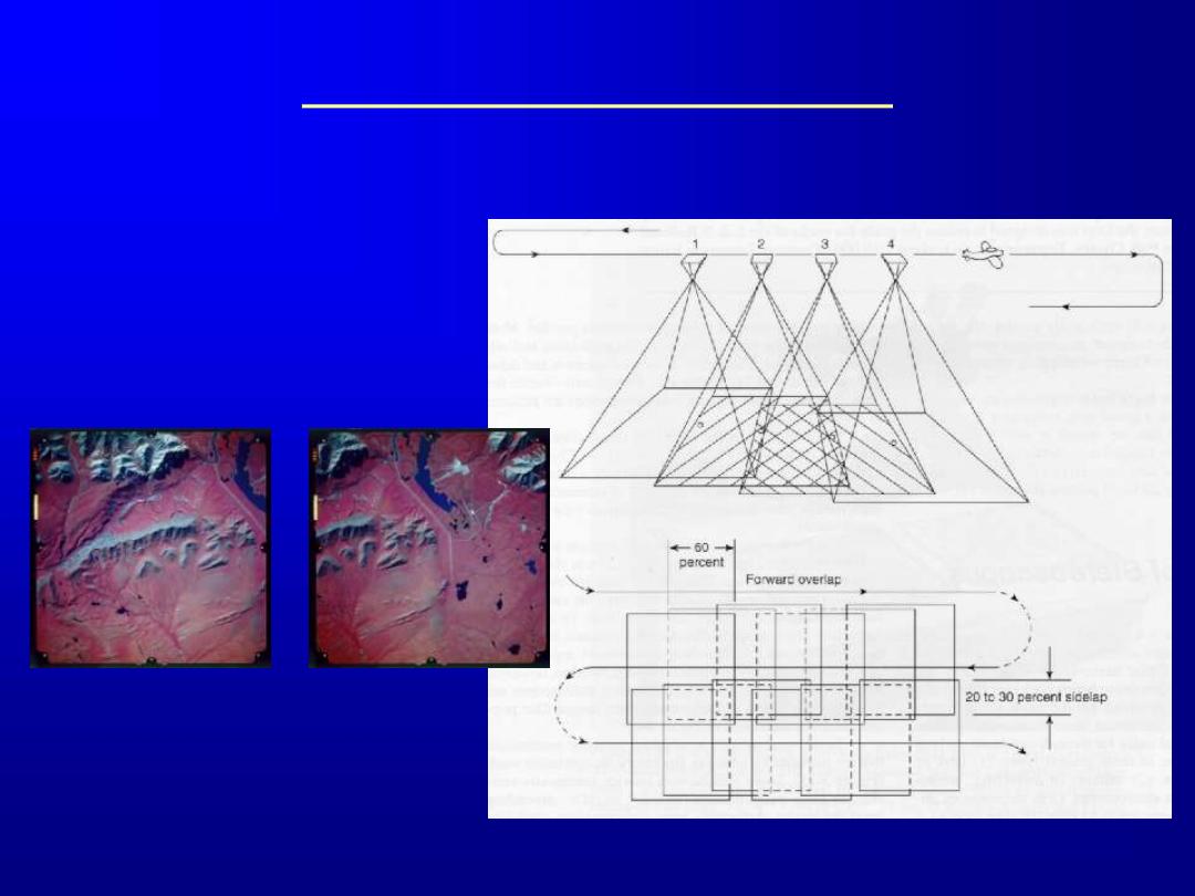
Types of Air Photos
Vertical
Stereo/3D
Color infrared (CIR)
stereopair of the
Galbraith Lake, Alaska
area.
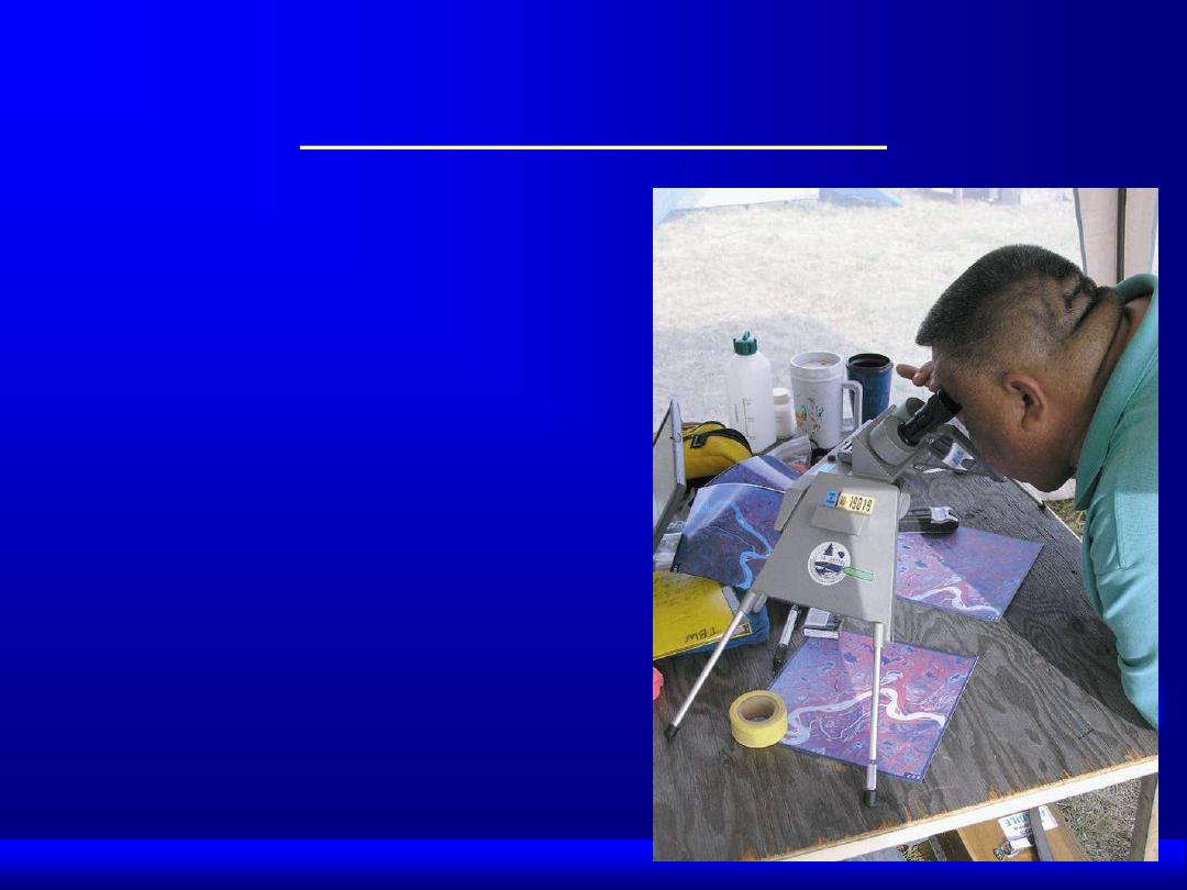
Types of Air Photos
Using a stereoscope to
view CIR stereopairs in
the field
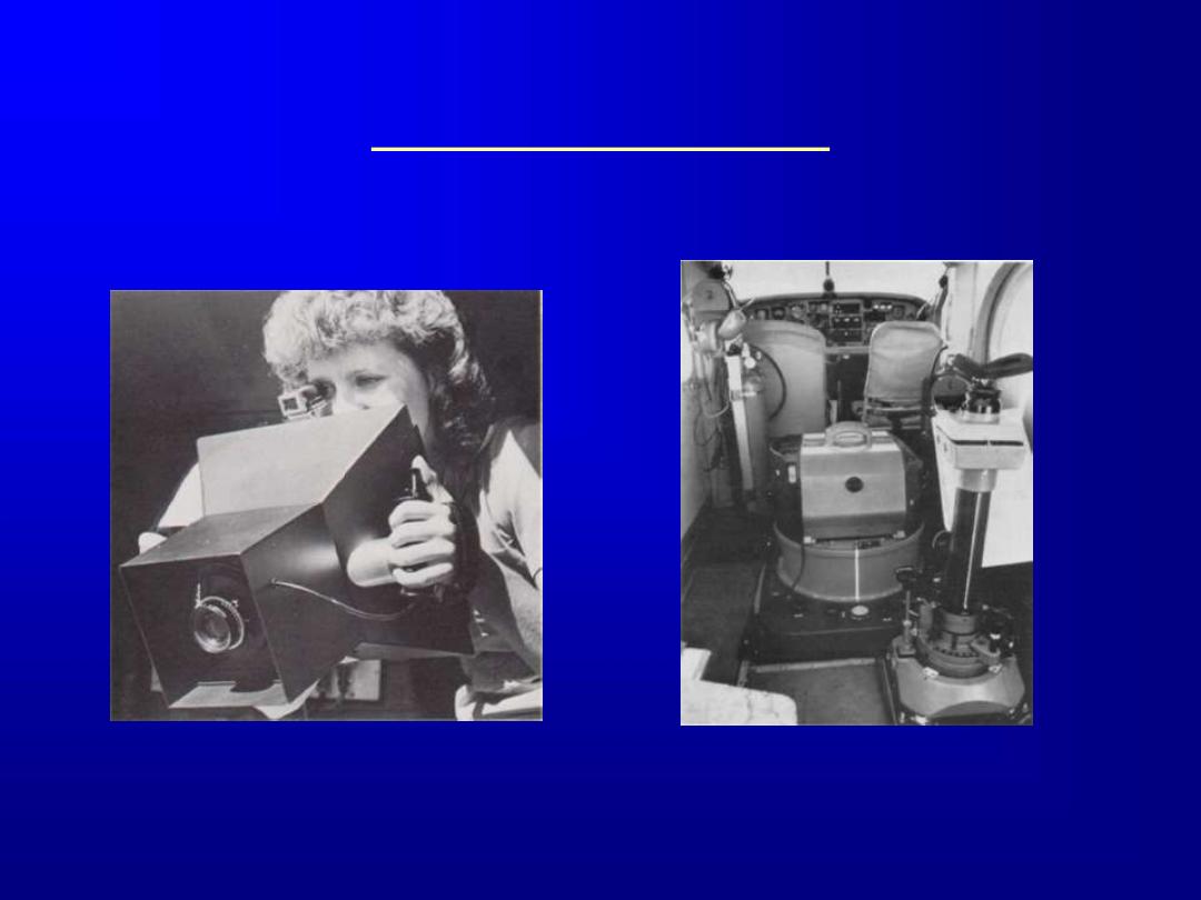
Aerial Cameras
A large format oblique
camera
Keystone’s Wild RC-
10 mapping camera

Film Types
Panchromatic (B& W)
– most often used in photogrammetry
– cheap
Color
– easy to interpret
– fuzzy due to atmospheric scattering

More Film Types
Black & White Infrared
– popular for flood mapping (water appears very
dark)
– vegetation mapping
– soils - dry vs. moist
False Color Infrared (CIR, Standard False
Color)
– vegetation studies
– water turbidity
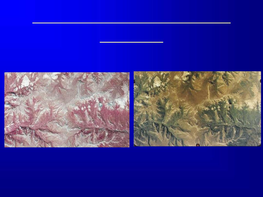
CIR and True Color Film Type
Examples
CIR
True Color

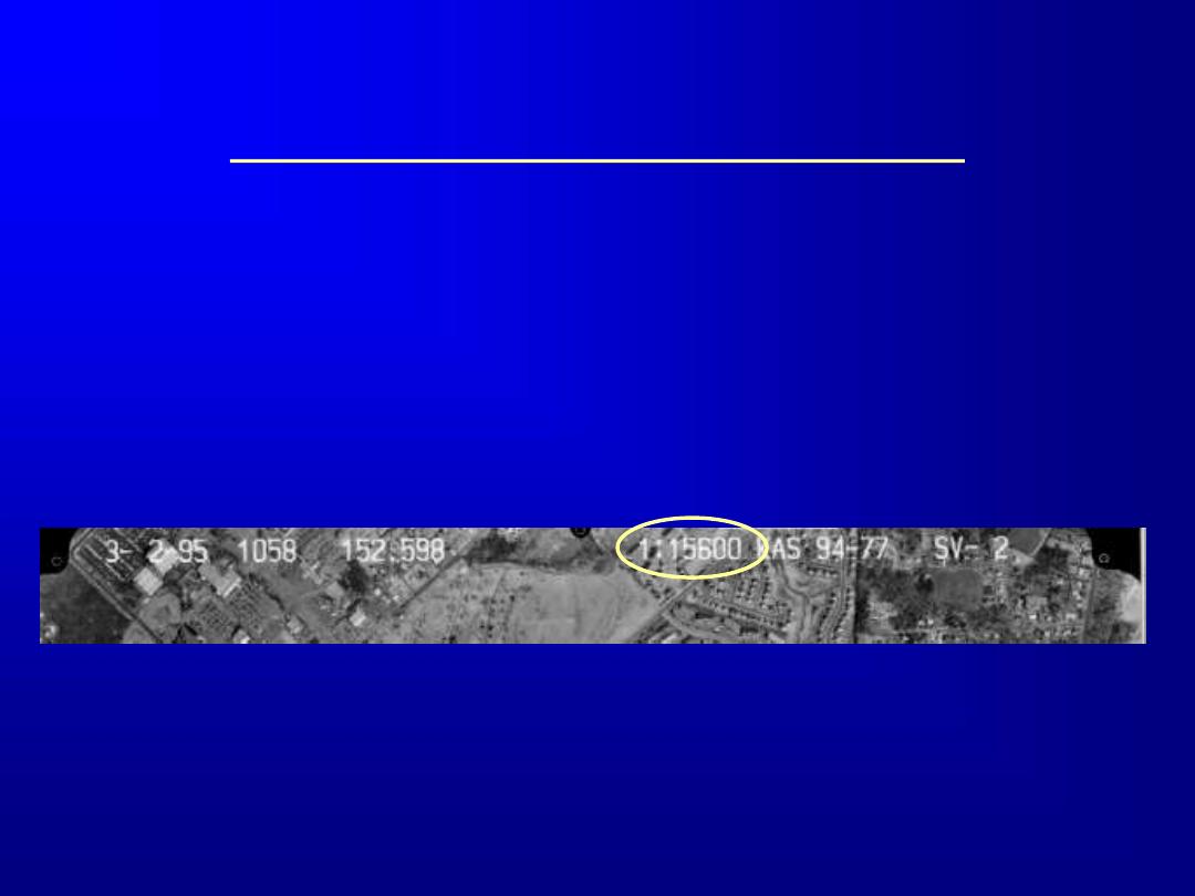
Printed Information/Annotation
Along the top edge, you’ll find:
– Date of Flight
– Time - (optional - beginning/end of flight line)
– Camera focal length in mm (optional - frequently
152.598 mm = 6”)
– Nominal scale (RF)
– Vendor/Job #
– Roll #, Flight line & Exposure #
Determining Photo Scale
Sometimes (at beginning and end of a flight line)
Nominal Scale is printed at the top of a photo,
usually as RF

Determining Photo Scale
the photo scale may be determined using the same geometry of a vertical
aerial photograph in figure 7.6. Again, from similar triangle Lop and LOP, we
may write:
where:
PS is the photo scale,
f is the focal length of the camera used to take the photograph, and
H-h is the flying altitude of the aircraft above the ground, which may be the
average elevation of the entire project area, the average elevation of the
photograph -or between two points on the photograph, or the elevation of a
single point on the ground.

Determining Photo Scale
You can also roughly estimate scale from
cultural features if there are any in the
image (problematic in Alaska), e.g., tracks,
athletic fields, etc.
Determining Photo Orientation
Labels and annotation
are almost always
along northern edge of
photo
Sometimes eastern
edge is used
Only way to be certain
is to use a map
Photointerpretation: Recognition Elements
Shape
Size
Color/Tone
Texture
Pattern
Site
Association
Shadow

Photointerpretation: Recognition Elements
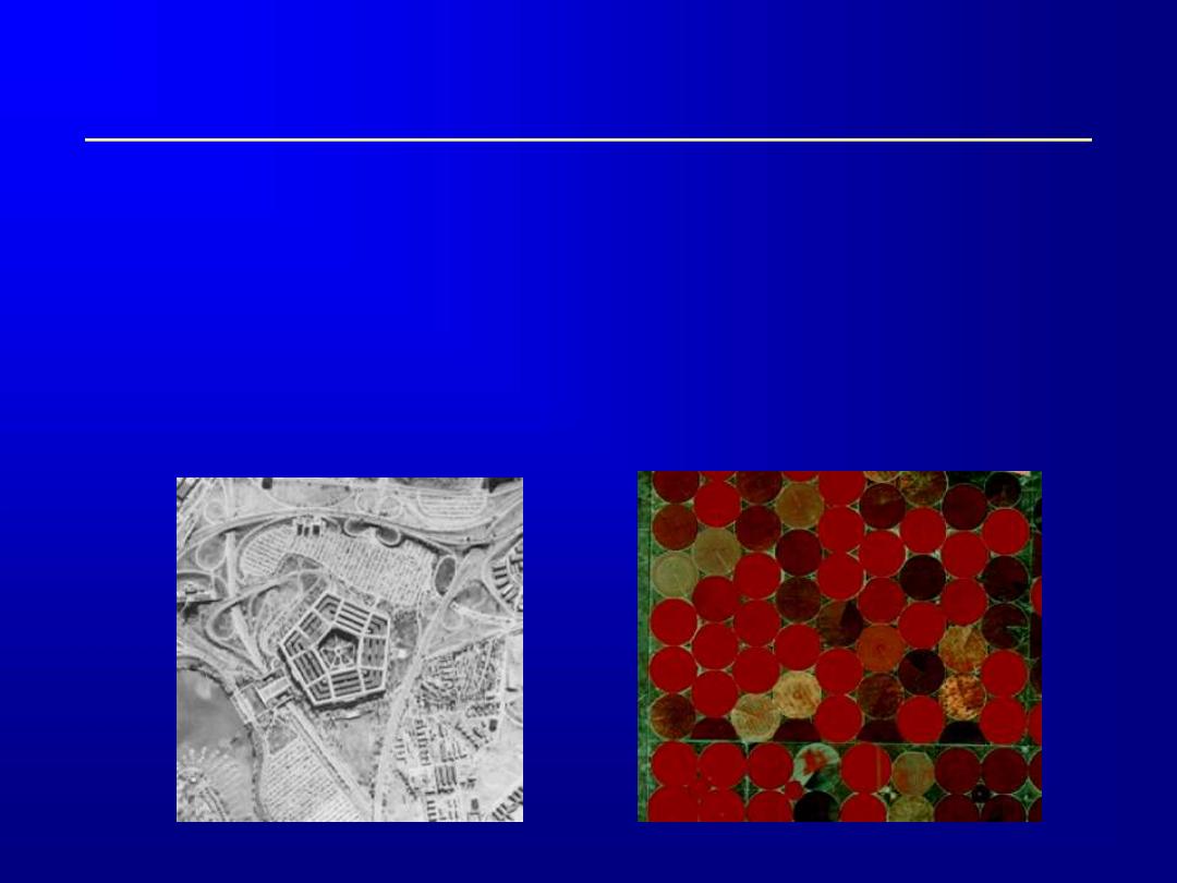
Shape
– cultural features - geometric, distinct boundaries
– natural features - irregular shapes and boundaries
– Shape helps us distinguish old vs. new subdivisions, some
tree species, athletic fields, etc.
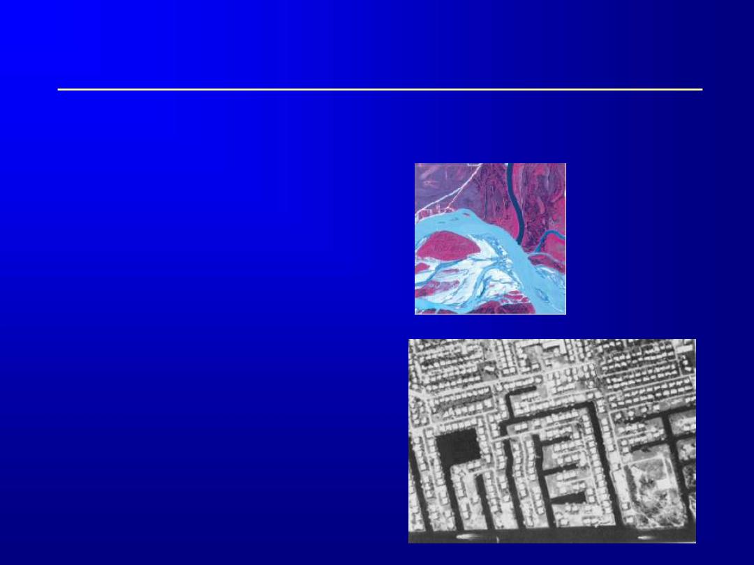
The pentagon
Meandering river
in Alaska
Interior Alaskan
village (note airstrip
near top of image)
Photointerpretation: Recognition Elements
Size
– relative size is an
important clue
– big, wide river vs.
smaller river or slough
– apartments vs. houses
– single lane road vs.
multilane

Photointerpretation: Recognition Elements
Color/Tone
– coniferous vs. deciduous trees
CIR - Spruce forest
(black) with some
deciduous (red)
trees.
CIR – Deciduous
(leafy) vegetation
(red).
CIR- Mixed spruce
And deciduous forest
on hillside with tundra
in valley bottom.
Photointerpretation: Recognition Elements
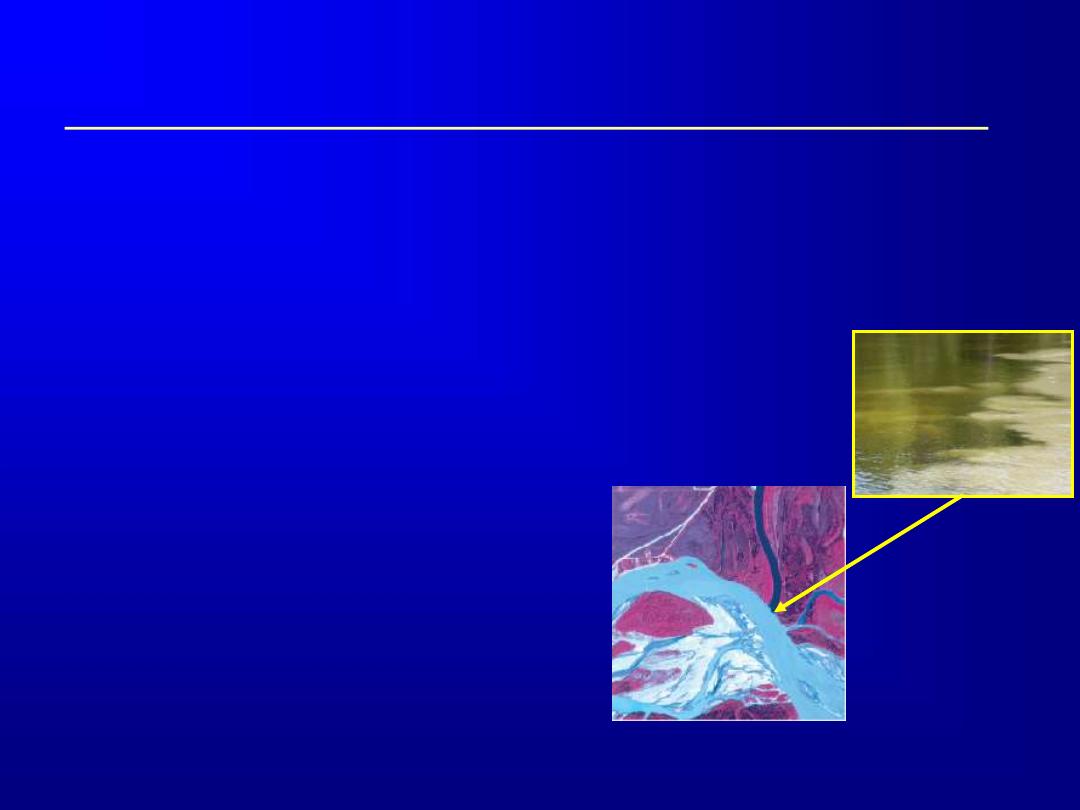
Color/Tone
– Turbidity - relative amounts of sediment in water
– Vegetation presence or absence
CIR – The big, light blue river in the lower
part of the image is the Tanana River. It
carries fine particles eroded by glaciers in the
Alaska Range.
The smaller dark blue river flows south from
top of the image to the Tanana River. It is
fed by surface runoff and groundwater
sources and does not carry much sediment.
Unvegetated gravel bars look bright bluish
white.
Photo by Maria Sotelo
Relatively clear Chena
River water
Turbid Tanana River water
Photointerpretation: Recognition Elements
Texture
– coarseness/smoothness caused by variability or
uniformity of image tone or color
– smoothness – tundra, swamps, fields, water, etc.
– coarseness - forest, lava flows, mountains etc.
CIR- Marshy
tundra with many
small ponds.
CIR - Bare rounded
Mountains (blue)
surrounded by tundra
and lakes.
CIR - Tundra showing
drainage pattern
Photointerpretation: Recognition Elements
Pattern
– overall spatial form of
related features
– repeating patterns tend
to indicate cultural
features - random =
natural
– drainage patterns can
help geologists
determine bedrock type
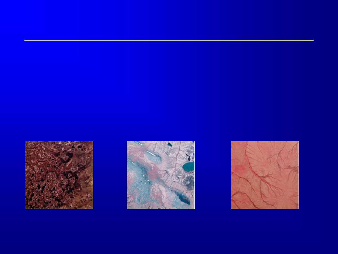
A dendritic pattern is characteristic
of flat-lying sedimentary bedrock

Photointerpretation: Recognition Elements
Site
– site - relationship of a
feature to its environment
– differences in vegetation
based on location:
In interior Alaska, black
spruce dominant on the
north side of hills and
deciduous trees on the south
side.
Vegetation is often has
different characteristics by
rivers than away from them
Meandering
Alaskan river
Interior Alaskan
hillside
N

Photointerpretation: Recognition Elements
Association
– identifying one feature can help identify another -
correlation
The white cloud and
black shadow have
the same shape, they
are related
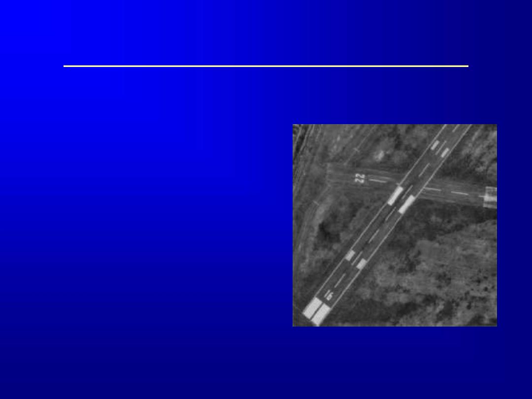
The long straight airstrip near
the top of the image indicates
that there might be a village or
settlement nearby

Photointerpretation: Recognition Elements
Shadows
– shadows cast by some
features can aid in
their identification
– some tree types,
storage tanks, bridges
can be identified in
this way
– shadows can
accentuate terrain
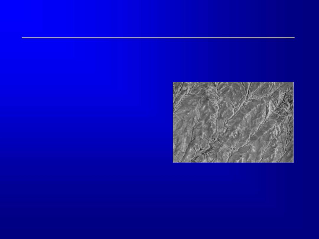
The mountain ridge on
the right side of this image
is accentuated by shadow